By Township Canada
Township Canada in Alberta: Energy and Agriculture Data on the DLS Grid
What Township Canada covers in Alberta, its deepest province: wells, pipelines, facilities, production, Crown and mineral tenure, CCS and geothermal tenure, the LSRS Productivity Score, soil, and crop history on the DLS grid.
Alberta is where the Dominion Land Survey grid does the most work. The Alberta Energy Regulator licenses every well, pipeline, and facility by legal land description. AGRASID rates farmland soil quarter section by quarter section. AFSC crop insurance, land surveying, and title administration all run on the same townships, ranges, and sections. Alberta is Township Canada's home province, and it has the deepest coverage of any province, including layers and a productivity score that exist nowhere else.
The Alberta survey grid
Alberta is described entirely in the DLS system, with ranges measured west of three meridians: the 4th (W4) along the Saskatchewan border in the east, the 5th (W5) through the central corridor around Edmonton and Calgary, and the 6th (W6) in the west toward the British Columbia boundary. Drop a quarter section or LSD like 06-32-048-07W5 into the Alberta legal land converter and it resolves to a precise parcel on the grid.
For background, see The Dominion Land Survey System Explained and Understanding Legal Subdivisions (LSDs).
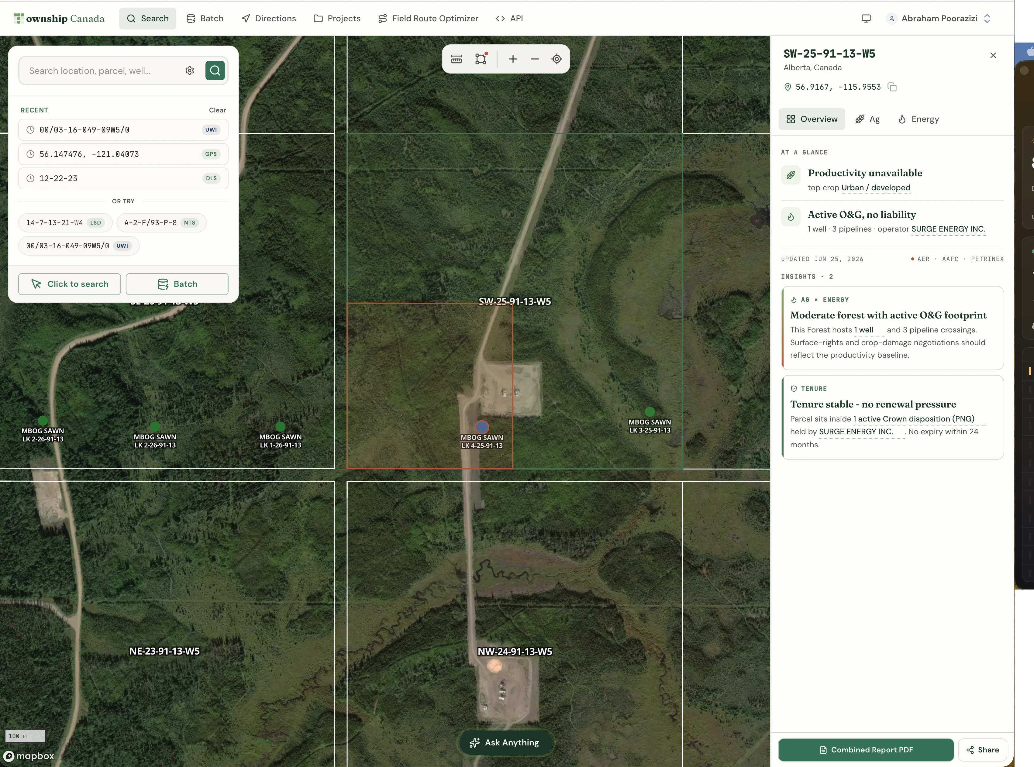
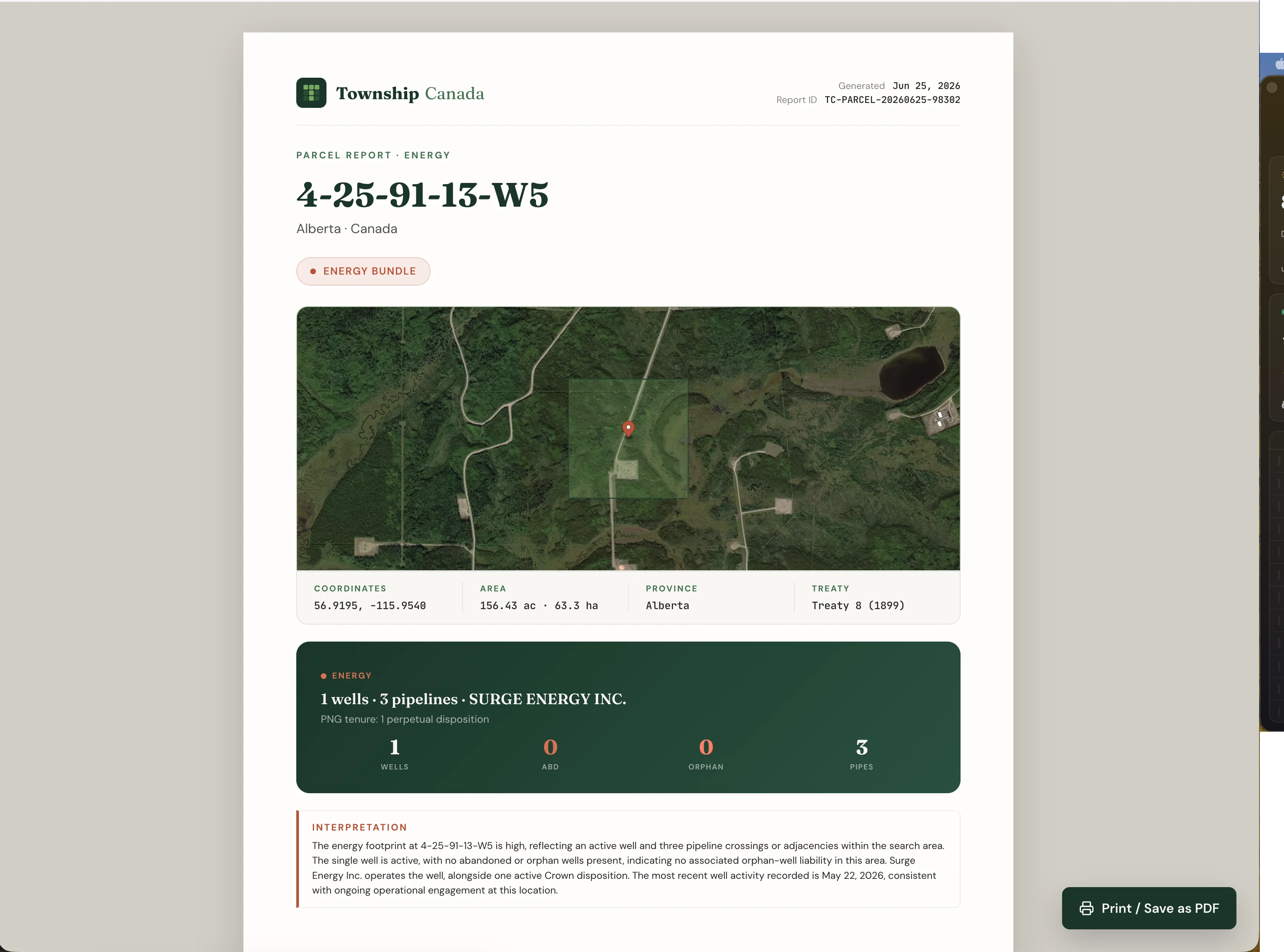
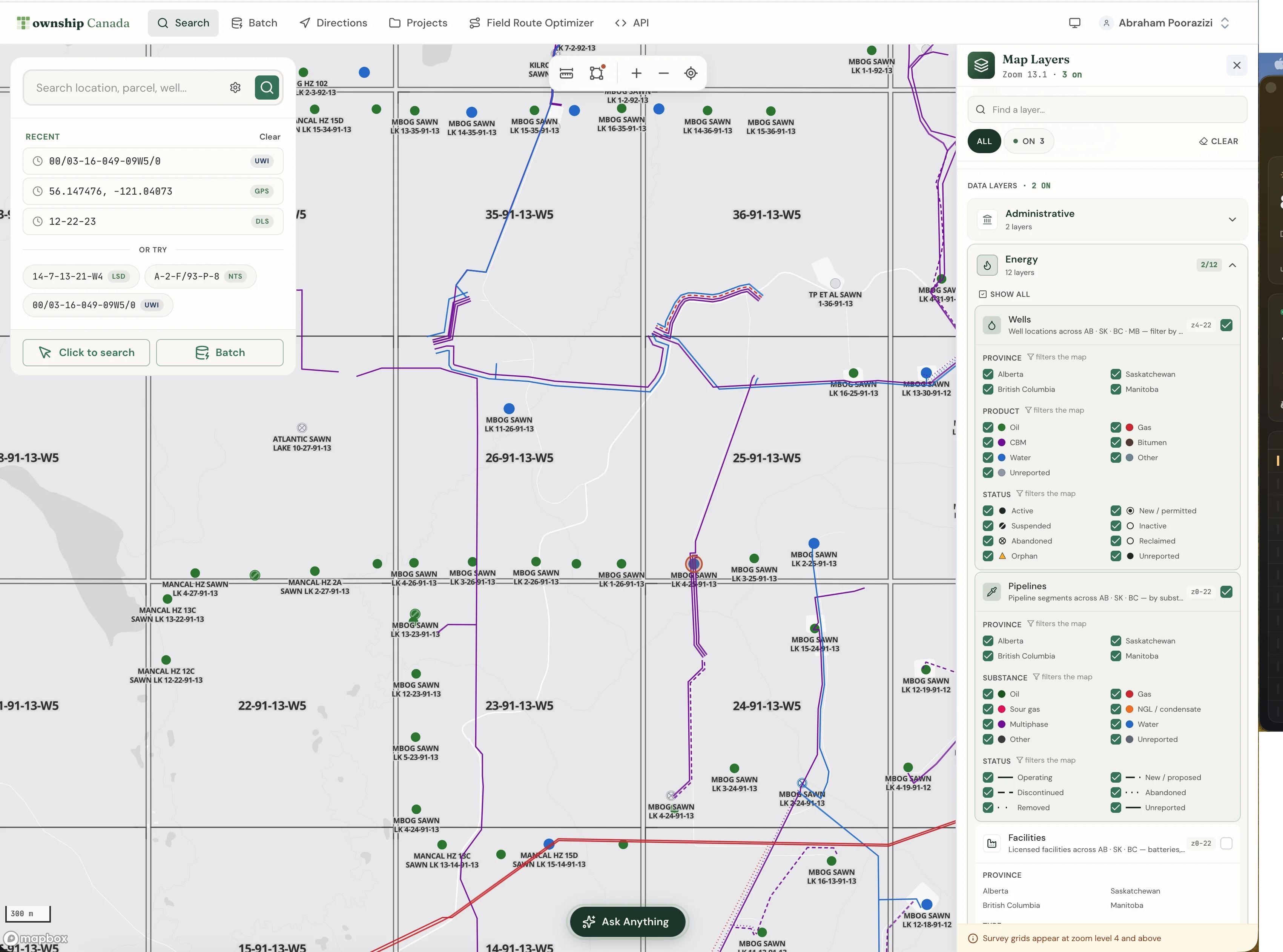
Energy data in Alberta
Alberta has the most complete energy coverage of any province. The Energy Bundle brings the full AER and Petrinex stack onto the grid:
- Wells with lifecycle status, more than 530,000 from the AER ST37 list, each carrying its orphan and abandoned flags.
- Pipelines and facilities, more than 124,000 facilities from the AER ST102 list, categorized into readable buckets.
- 12-month production rollups for producing wells.
- Oil and gas fields and pools as boundary layers.
- Crown petroleum and natural gas tenure and Crown mineral tenure, with more than 63,000 Crown PNG dispositions in Alberta, each carrying holder, type, status, and expiry.
- Operator (BA) snapshots that roll up a licensee's portfolio by status, including orphan and reclamation-certified counts.
Two layer families are unique to Alberta: CCS pore-space, CCS project, and CCS injection tenure, and geothermal tenure. These are free layers, separate from the Energy Bundle, so anyone can see carbon-storage and geothermal lease blocks on the grid. Wells and Fields and Pools are also free. Pipelines, facilities, production, and the petroleum and mineral tenure layers unlock with the Energy Bundle on a Pro or Business plan.
Agriculture data in Alberta
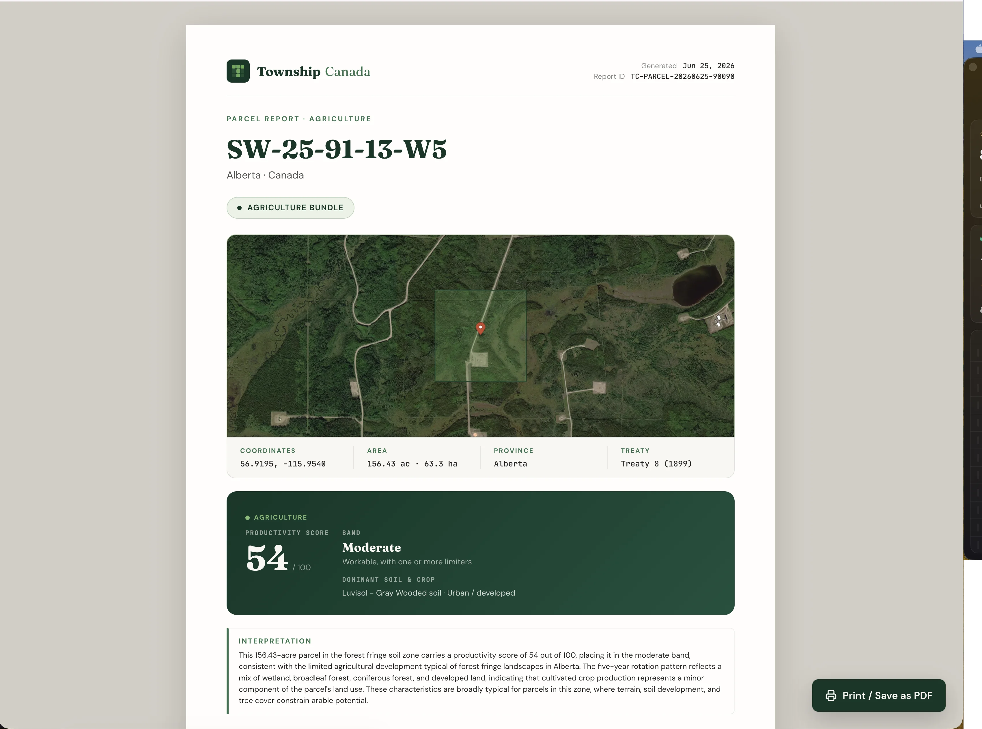
Alberta is the only province with the flagship productivity score, and the Agriculture Bundle delivers the complete stack:
- LSRS Productivity Score, a 0-100 rating built on AGRASID 4.1, on more than 410,000 Alberta quarter sections. This is the headline soil-productivity number, and it exists only in Alberta. See what the LSRS score tells you.
- Detailed AGRASID soil survey polygons, with soil order, group, drainage, and parent material.
- CLI agricultural capability class, 5-year AAFC crop history with rotation pattern and diversity index, land use, and current drought status.
For AFSC filers, the value is the same as filing declared acres anywhere: confirm each quarter section lands on the field you actually farm before the form goes in. See AFSC Declared Acres: Verify Alberta Quarter Sections Before Submitting.
An Alberta workflow
Take a landman or an analyst looking at a quarter in the Pembina field near Drayton Valley, for example 06-32-048-07W5. Enter it in the Alberta converter, toggle on the Wells, Pipelines, and Facilities layers, and the energy picture is on one screen. Click a well to open the parcel report, which pulls the surrounding wells, pipeline crossings, oil and gas pools, operator snapshot, and Crown tenure. If you also hold the Agriculture Bundle, the same report carries the LSRS productivity score, soil, and crop context for the quarter.
How current the data is
Township Canada refreshes each dataset on the same cadence as its source:
- Wells, pipelines, facilities, production, and pools: refreshed monthly from the AER and Petrinex open-data releases.
- Crown petroleum, natural gas, and mineral tenure: refreshed weekly, so renewal and expiry flags stay current.
- LSRS productivity, soil survey, crop history, land use, and capability: refreshed annually, with the LSRS score updating each June. The drought layer refreshes monthly.
How to turn it on
The Alberta layers are part of the existing Energy and Agriculture Bundles, which stack on a Pro or Business plan. The free Wells, Fields and Pools, CCS, and geothermal layers are available to anyone. See the pricing page for the breakdown.
If your work spans more than one province, see the oil and gas industry page and the agriculture industry page for the cross-province workflows.