By Township Canada
Township Canada in British Columbia: Energy, Farmland, and the NTS and DLS Grids
What Township Canada covers in British Columbia: northeast BC wells, pipelines, facilities, Crown tenure, the BC Agricultural Land Reserve, BC ag capability, soil survey, and parcel boundaries, on the NTS and Peace River DLS grids.
British Columbia describes land two ways, and Township Canada handles both. Most of the province is referenced by National Topographic System (NTS) map sheets, while the Peace River block in the northeast sits on the same Dominion Land Survey grid used across the Prairies. A landman working the Montney near Fort St. John, a rural realtor listing an Okanagan acreage, and a farmland buyer in the Cariboo all need different data on different grids. This page is the running summary of what Township Canada covers in British Columbia and how to reach it.
The British Columbia survey grids
Enter an NTS reference like 094A/03 into the BC NTS converter and the map sheet resolves to its geographic extent. In the Peace River block, where the DLS grid overlaps, a legal land description like SW-22-79-15-W6 resolves the same way it does in Alberta. The converter takes either reference style and returns the same parcel context, so northeast BC professionals can move between the NTS sheet they hold and the DLS quarter the survey lease references.
For background, see The National Topographic System (NTS) Explained and British Columbia Legal Land Descriptions.
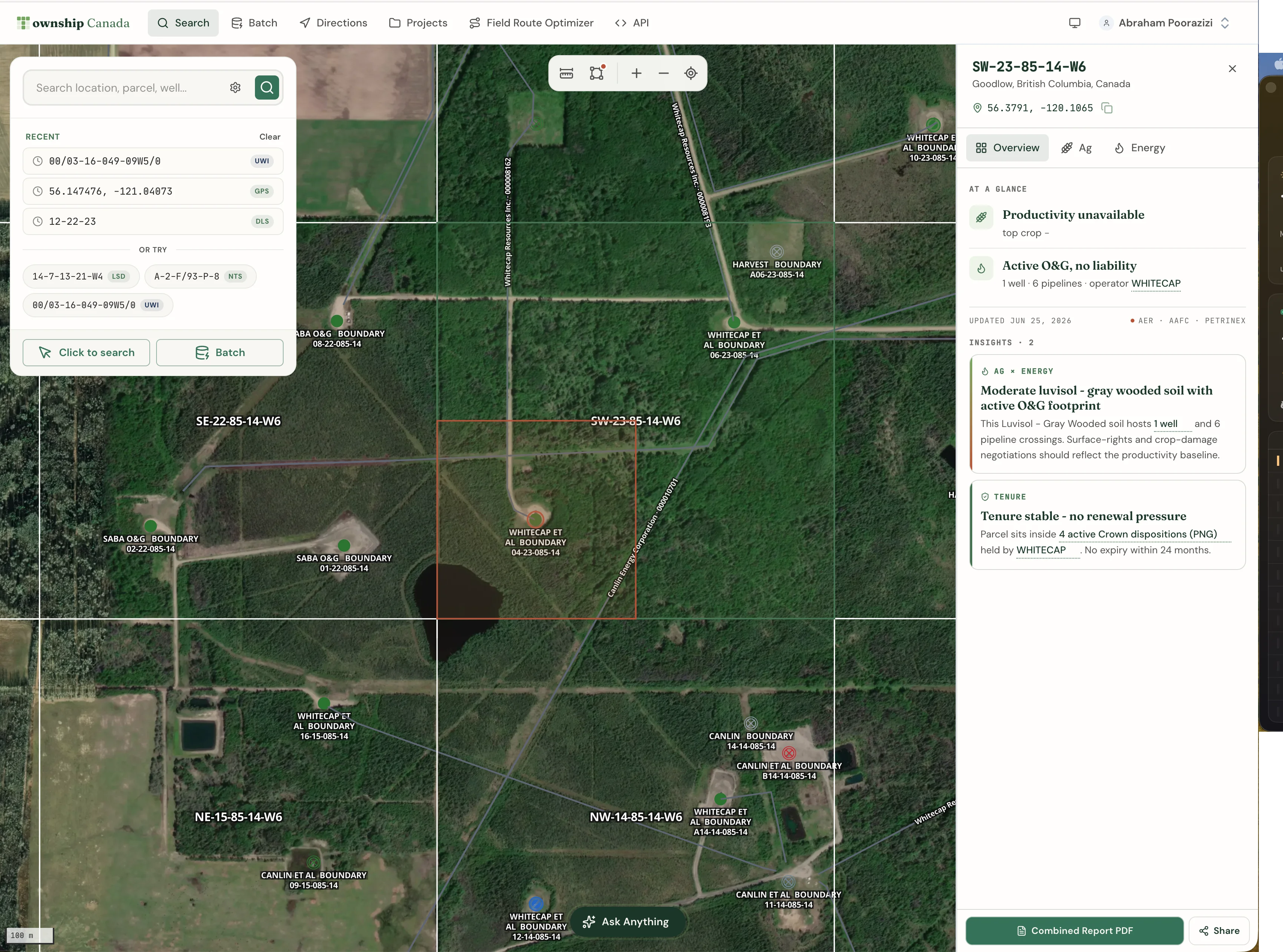
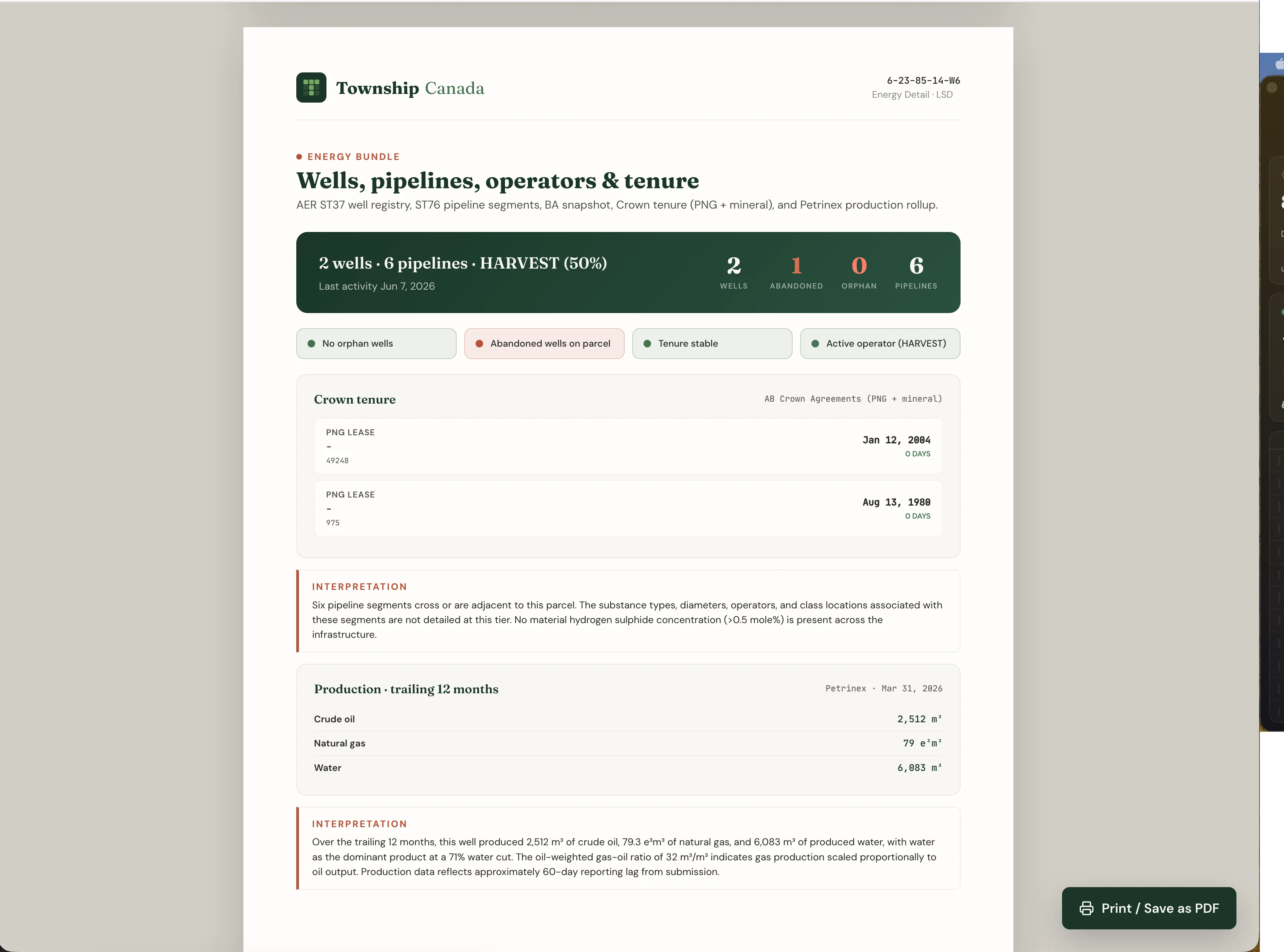
Energy data in British Columbia
The Energy Bundle covers British Columbia across the energy stack, concentrated in the active northeast:
- Wells with lifecycle status across the Montney play and the wider Peace River and northeast BC region.
- Pipelines and facilities rendered on the grid.
- 12-month production rollups.
- Oil and gas fields and pools as boundary layers.
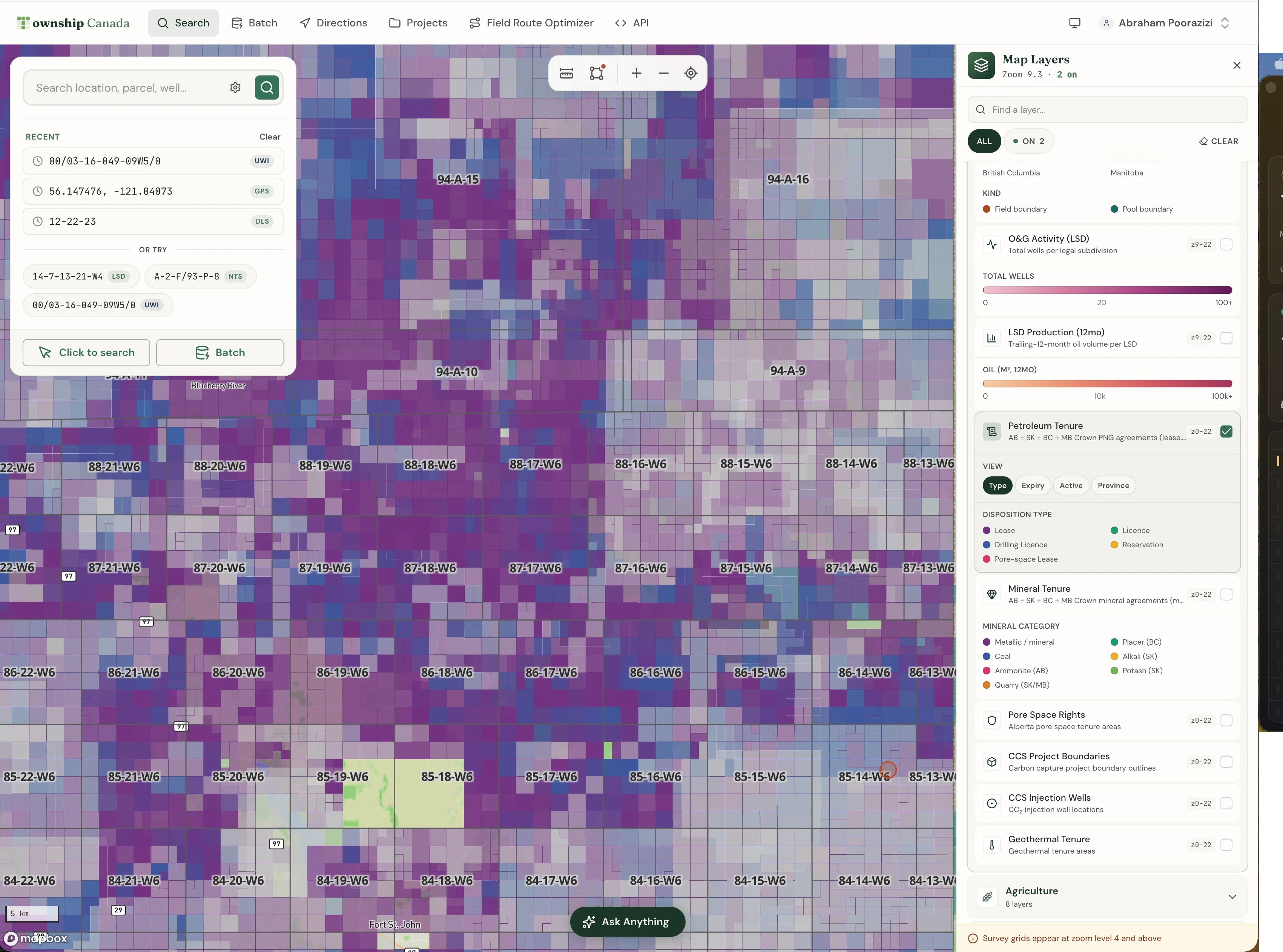
- Crown petroleum and natural gas tenure and Crown mineral tenure, with more than 41,000 Crown PNG dispositions in British Columbia, each carrying holder, type, status, and expiry.
On the map, Wells and Fields and Pools are free base layers; pipelines, facilities, production, and tenure unlock with the Energy Bundle on Pro or Business. The parcel report Energy tab summarizes every well, pipeline crossing, facility, operator, and tenure interest that touches the parcel.
CCS pore-space and geothermal tenure are currently Alberta layers and do not yet cover British Columbia.
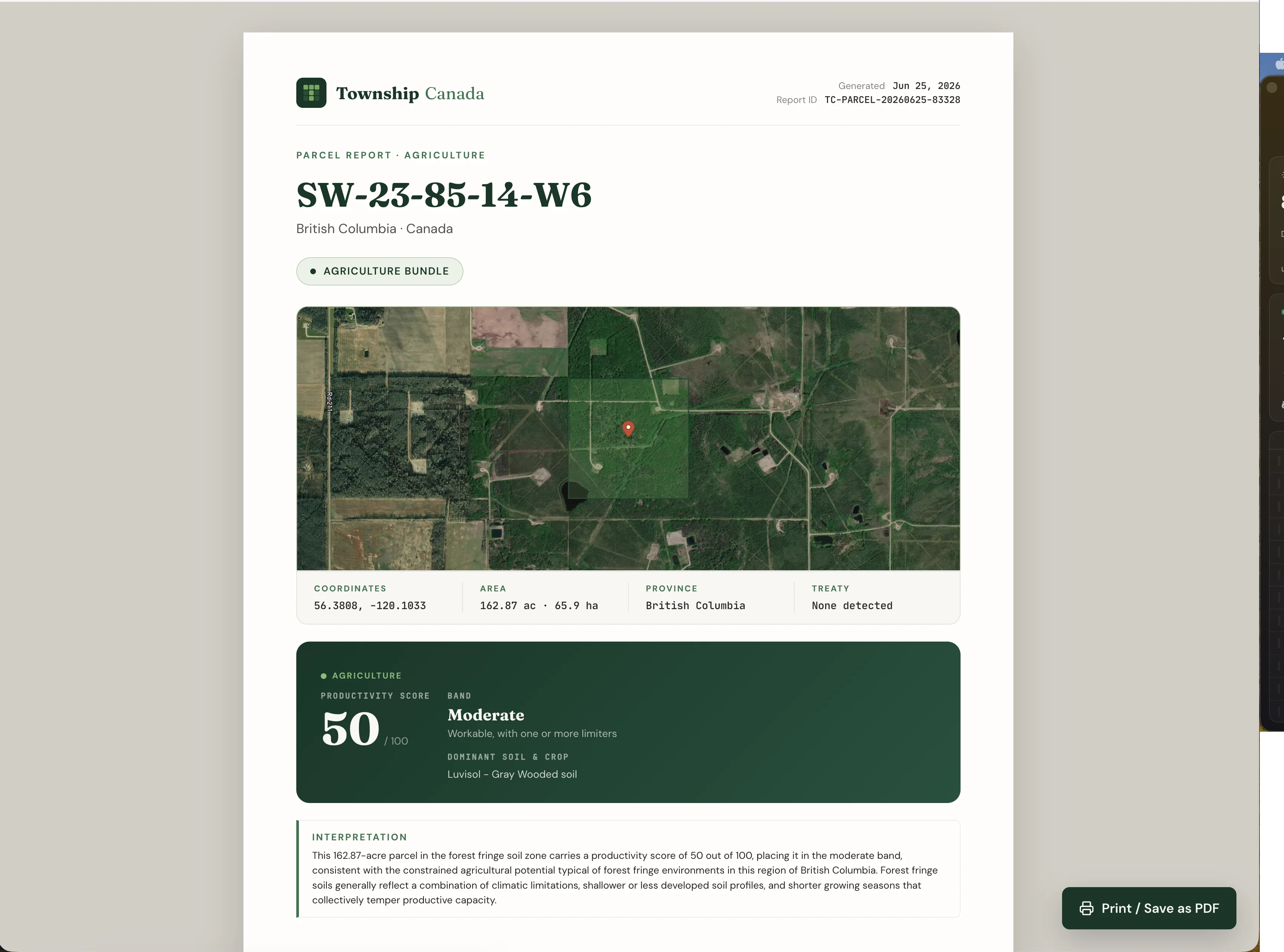
Agriculture data in British Columbia
British Columbia agriculture has its own framing, and the Agriculture Bundle reflects it:
- BC Agricultural Land Reserve (ALR) with labels, the standout layer for rural real estate. A single toggle shows whether a property sits inside the ALR, which is the difference between a routine rural transaction and one that needs an ALR exclusion application.
- BC Agricultural Capability, the province's own 7-class rating. This is a different scale from Alberta's LSRS Productivity Score, and the two should not be compared directly. Where Alberta reports a 0-100 LSRS score, British Columbia reports its 7-class capability rating.
- BC soil survey polygons, plus the national CLI capability, 5-year AAFC crop history, land use, and current drought status.
- Freshwater Atlas (FWA) wetlands, which affect surface-lease setbacks and reclamation planning.
Combined with parcel boundaries from the ParcelMap BC layer (see the ParcelMap BC integration post), a BC agent can see the survey grid, parcel boundaries, ALR status, and soil capability on one screen.
A northeast BC workflow
Northeast BC professionals work with NTS sheets like 094A/03 near Fort St. John and, inside the Peace River block, the DLS grid. Enter the NTS reference in the BC NTS converter, toggle on the Wells, Pipelines, and Fields & Pools layers, and filter to British Columbia. The well inventory inside the sheet renders on the same view. Add the BC Agricultural Land Reserve layer if the parcel touches farmland, and the FWA wetlands layer to surface water features near the lease.
How current the data is
Township Canada refreshes each dataset on the same cadence as its source:
- Wells, pipelines, facilities, production, and fields: refreshed monthly from each regulator's open-data release.
- Crown petroleum, natural gas, and mineral tenure: refreshed weekly, so renewal and expiry flags stay current.
- Soil survey, ag capability, crop history, and land use: refreshed annually as new source data is published. The drought layer refreshes monthly.
How to turn it on
The British Columbia layers are part of the existing Energy and Agriculture Bundles. There is no separate BC SKU. The bundles stack on a Pro or Business plan, and the free Wells and Fields and Pools layers are available to anyone. See the pricing page for the breakdown.
If your work spans more than one province, see the oil and gas industry page and the agriculture industry page for the cross-province workflows.
Related
- Saskatchewan, BC, and Manitoba Energy and Agriculture Map Layers Are Now Live
- ParcelMap BC parcel boundaries on the map
- BC NTS Grid References: Convert to GPS for Field Work
- Multi-province energy map: one Wells layer across AB, SK, BC, and MB
- Township Canada for Oil and Gas Operators
- Township Canada for Farmers