By Township Canada
Township Canada in Saskatchewan: Energy and Agriculture Data on the DLS Grid
What Township Canada covers in Saskatchewan, on the DLS grid you already use: wells, pipelines, facilities, Crown petroleum and mineral tenure, production, soil survey, crop history, and agricultural Crown land.
Saskatchewan land work runs on the Dominion Land Survey grid, the same townships, ranges, and sections that organize the rest of the Prairies. A landman in the Williston Basin near Estevan, a grain farmer filing declared acres with SCIC, a farmland buyer checking a Crown lease near Swift Current, and a surveyor staking a quarter near Lloydminster all describe the same ground the same way: by legal land description. What they have lacked is one place that puts the energy and agriculture data on that grid.
Township Canada does exactly that for Saskatchewan. Drop a quarter section or LSD into the Saskatchewan legal land converter and the well, pipeline, tenure, soil, and crop layers render on the same DLS grid your descriptions already reference. This page is the running summary of what is covered in Saskatchewan and how to reach it.
The Saskatchewan survey grid
Saskatchewan is described almost entirely in the DLS system, with ranges measured west of the 2nd and 3rd meridians (W2 and W3). The 4th meridian forms the Saskatchewan-Alberta boundary. Every dataset below is keyed to that grid, so a legal land description like SW-22-49-23-W3 resolves to a precise quarter section with no manual coordinate conversion.
For background on how the grid is numbered, see The Dominion Land Survey System Explained and Understanding Legal Subdivisions (LSDs).
Energy data in Saskatchewan
The Energy Bundle covers Saskatchewan across the full energy stack:
- Wells with lifecycle status, sourced from the Saskatchewan GeoAtlas, spanning the Williston Basin south of Estevan, the Bakken trend, the heavy oil belt around Lloydminster and Kindersley, and everything between.
- Pipelines and facilities rendered as line work and labelled markers on the grid.
- 12-month production rollups for producing wells.
- Oil and gas fields and pools as boundary layers.
- Crown petroleum and natural gas tenure and Crown mineral tenure, with more than 19,000 Crown PNG dispositions in Saskatchewan alone, each carrying holder, type, status, and expiry so you can flag tenure coming up for renewal.
On the map, Wells and Fields and Pools are free base layers. Pipelines, facilities, production, and the tenure layers unlock with the Energy Bundle on a Pro or Business plan. In the parcel report, the Energy tab summarizes every well, pipeline crossing, facility, operator, and tenure interest that touches the quarter.
CCS pore-space and geothermal tenure are currently Alberta layers and do not yet cover Saskatchewan.

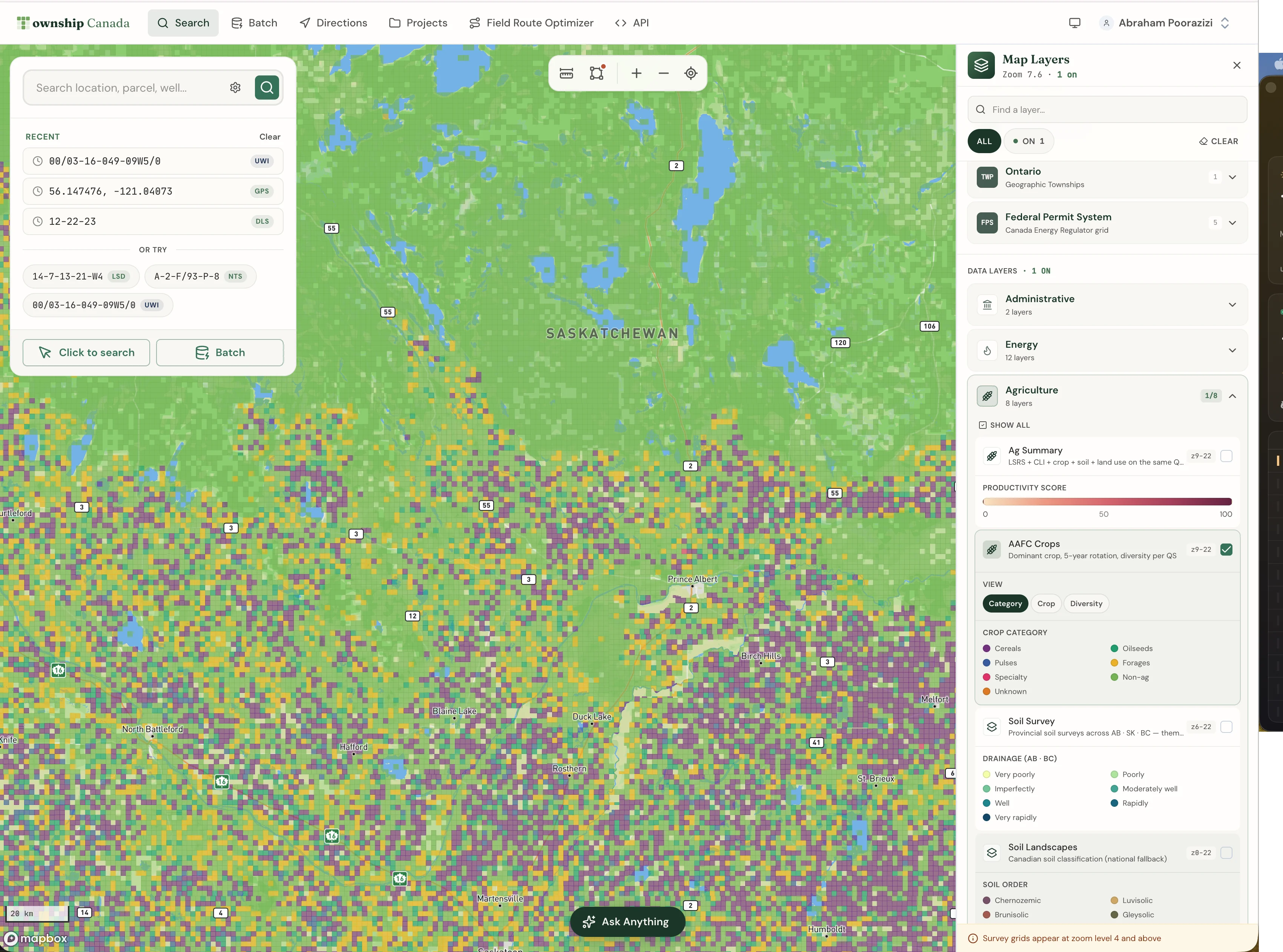
Agriculture data in Saskatchewan
The Agriculture Bundle brings the farmland datasets onto the same grid:
- Detailed soil survey polygons for Saskatchewan, with soil order, group, drainage, and parent material feeding the parcel report soil section.
- CLI agricultural capability class, the national Canada Land Inventory rating.
- 5-year AAFC crop history, with dominant crop, rotation pattern, and a Shannon diversity index from the national Annual Crop Inventory.
- Land use breakdown and current drought status from the Canadian Drought Monitor.
- Saskatchewan Agricultural Crown Land and provincial pastures, the working layers for farmland buyers and crop insurance work, so you can see whether an adjacent half-section is a provincial lease before a deal closes.
One honest note on the productivity score: the 0-100 LSRS Productivity Score is Alberta-only, because it is built on AGRASID, an Alberta soil dataset. In Saskatchewan the report leads with the detailed soil survey, the CLI capability class, and the crop rotation history instead. Saskatchewan does not yet have an open province-wide productivity rating.
For SCIC filers, the value is the same as it is in Alberta with AFSC: confirm each declared quarter section lands on the field you actually farm before the form goes in. See the Saskatchewan Quarter Section Guide for Grain Farmers and SCIC Filers.

A Saskatchewan workflow
Take a landman checking a quarter in the Bakken near Estevan, for example SE-10-3-7-W2. The old workflow was SaskGIS for the well permit map, a separate provincial viewer for the pipeline corridors, a third tab for the operator, and the legal land description converter to translate everything into the LSD format that goes on the surface lease.
Now: enter the description in the Saskatchewan converter, toggle on the Wells, Pipelines, and Facilities layers, filtered to Saskatchewan (they span all four provinces). The picture is on one screen. Click a well to open the parcel report, which pulls the surrounding wells, pipeline crossings, oil and gas pools, Crown tenure, and, if you also hold the Agriculture Bundle, the soil and crop context for the same quarter.

How current the data is
Township Canada refreshes each dataset on the same cadence as its source:
- Wells, pipelines, facilities, production, and pools: refreshed monthly from each regulator's open-data release.
- Crown petroleum, natural gas, and mineral tenure: refreshed weekly, so renewal and expiry flags stay current.
- Soil survey, crop history, land use, and capability: refreshed annually as new source data is published. The drought layer refreshes monthly.
How to turn it on
The Saskatchewan layers are part of the existing Energy and Agriculture Bundles. There is no separate Saskatchewan SKU. The bundles stack on a Pro or Business plan, and the free Wells and Fields and Pools layers are available to anyone. See the pricing page for the breakdown.
If your work spans more than one province, and most western Canadian land work does, see the oil and gas industry page and the agriculture industry page for the cross-province workflows.
Related
- Saskatchewan, BC, and Manitoba Energy and Agriculture Map Layers Are Now Live
- Multi-province energy map: one Wells layer across AB, SK, BC, and MB
- Unified soil survey layer for western Canada
- Saskatchewan Quarter Section Guide for Grain Farmers and SCIC Filers
- Township Canada for Oil and Gas Operators
- Township Canada for Farmers