By Township Canada
Township Canada in Manitoba: Wells, Tenure, and Farmland on the DLS and River Lot Grids
What Township Canada covers in Manitoba: southwest Manitoba wells, Crown petroleum, natural gas, and mineral tenure, oil and gas pools, and soil and crop data, on the DLS grid and the historic Red River lot system.
Manitoba describes land two ways, and Township Canada handles both. Most of the province sits on the Dominion Land Survey grid, with ranges measured east and west of the principal meridian. Along the Red and Assiniboine rivers near Winnipeg, the historic river lot system still governs title. A landman in the southwest Manitoba oil patch near Virden, a farmland buyer in the Pembina Valley, and a title researcher tracing a Red River parish lot all work in this province, and this page is the running summary of what Township Canada covers here.
The Manitoba survey grids
Manitoba ranges are numbered both east (E1, E2) and west (W1) of the principal meridian. The Manitoba legal land converter resolves DLS quarter sections and legal subdivisions on that grid.
It also handles the river lot system. Type a description like RL-103-PA (River Lot 103, Parish of St. Andrews) into the same search box and Township Canada recognizes the river lot format and places the elongated parcel along the river. For the history and format, see The Manitoba River Lot System and the River Lot Converter for Manitoba.
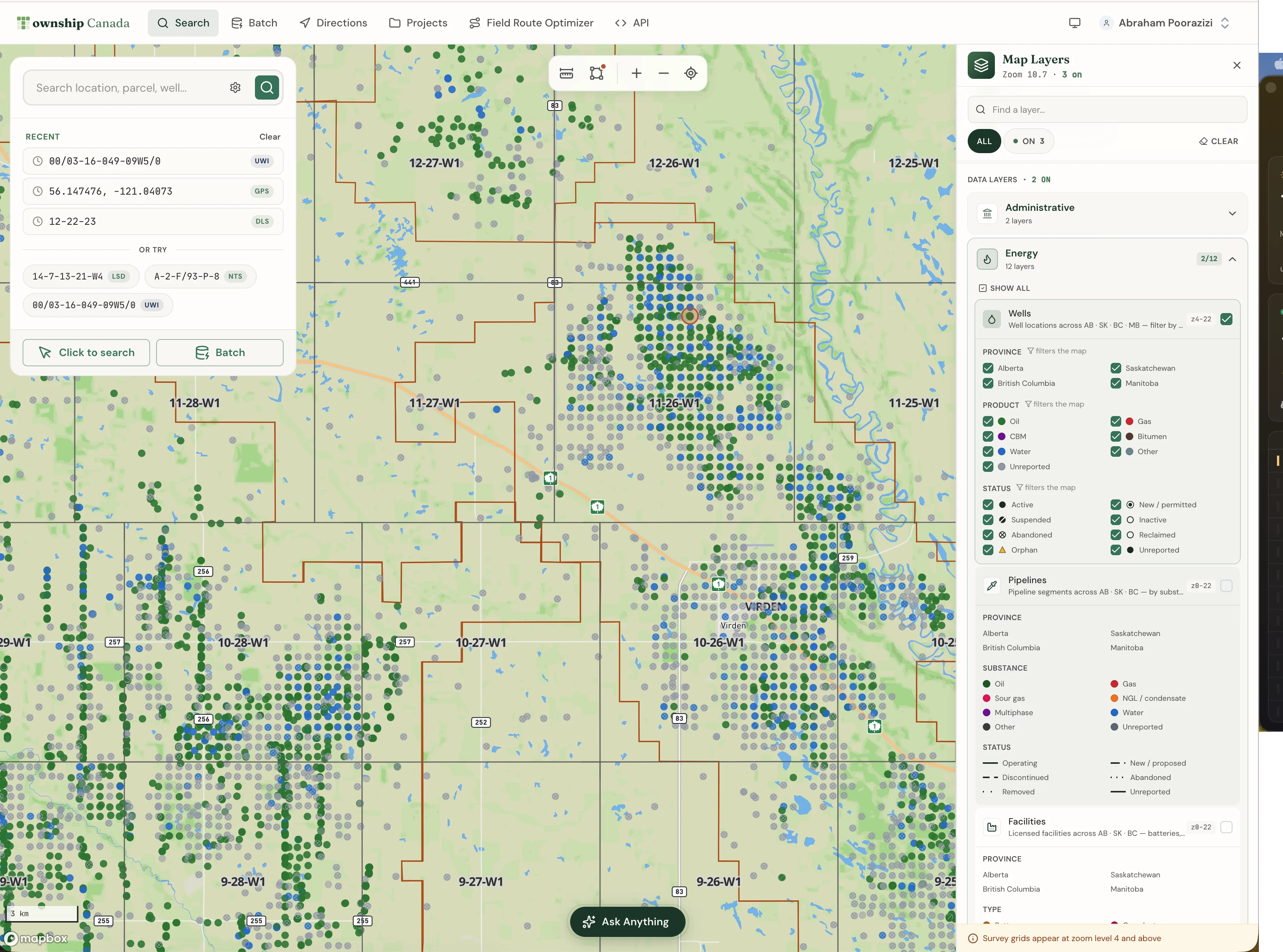
Energy data in Manitoba
Manitoba's oil patch is the Williston Basin in the southwest, around Virden, Waskada, Sinclair, and Pierson. The Energy Bundle covers it:
- Wells with lifecycle status, loaded from the Manitoba Petroleum Branch registry.
- Oil and gas pools as boundary layers.
- Crown petroleum, natural gas, and mineral tenure, each carrying holder, type, status, and expiry.
One honest scope note: Manitoba is not in Petrinex, the shared Prairie production and infrastructure system. Pipeline, facility, and 12-month production surfaces are therefore not available for Manitoba. The Manitoba energy coverage is wells, Crown tenure, and pools. On the map, Wells and Fields and Pools are free base layers; the tenure layers unlock with the Energy Bundle on Pro or Business.
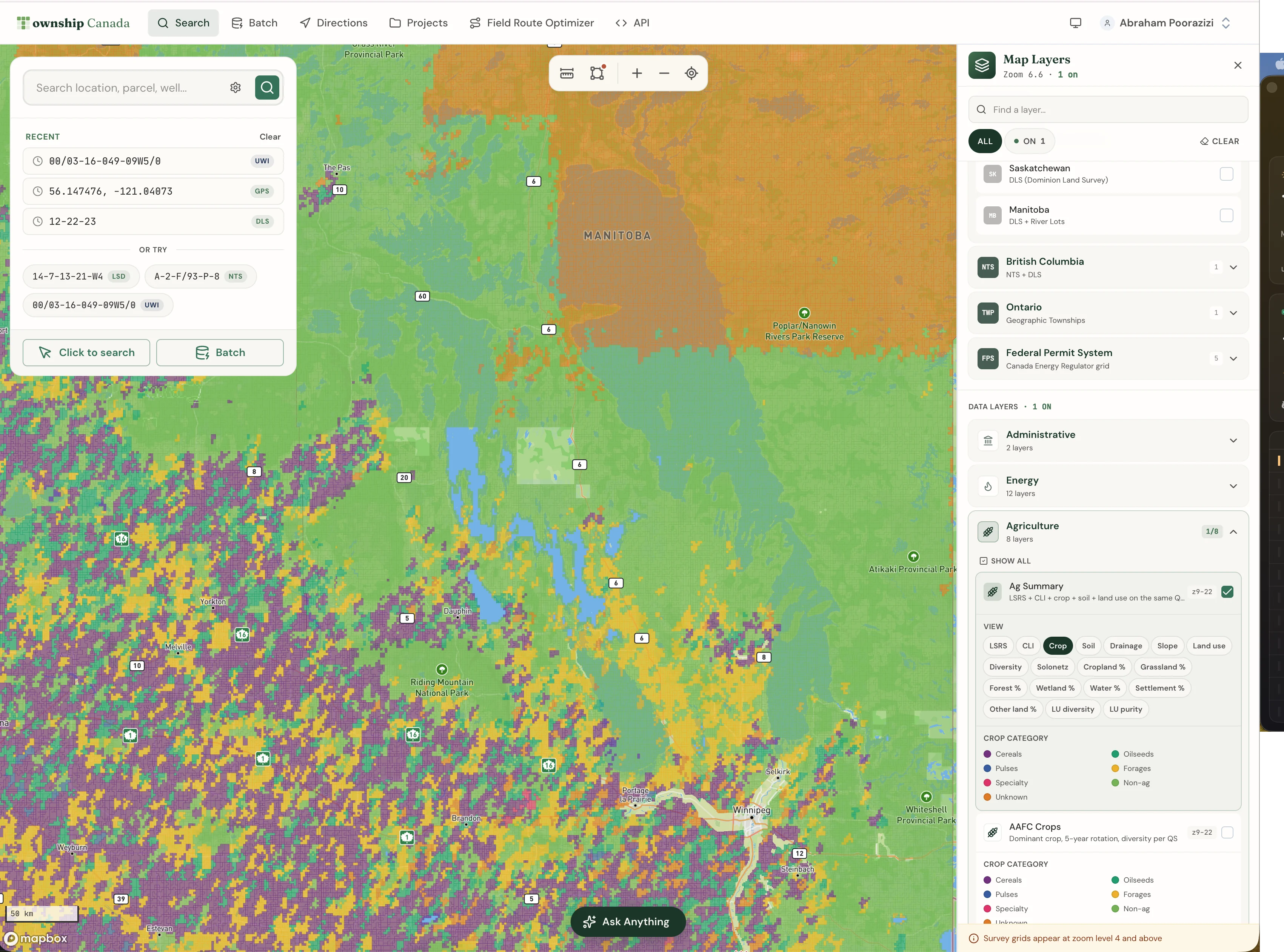
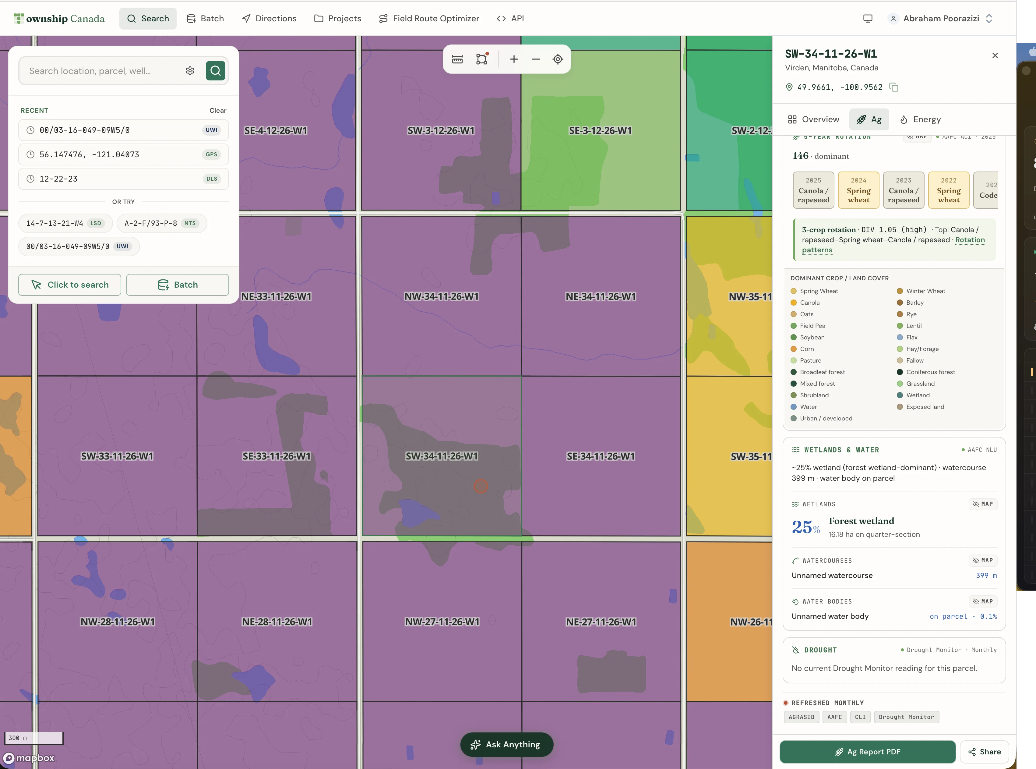
Agriculture data in Manitoba
The Agriculture Bundle brings the farmland datasets onto the Manitoba grid:
- Soil detail in the parcel report, with soil subgroup, drainage, and capability for any Manitoba quarter section.
- CLI agricultural capability class, the national Canada Land Inventory rating.
- 5-year AAFC crop history, with dominant crop, rotation pattern, and a diversity index from the national Annual Crop Inventory.
- Land use breakdown and current drought status from the Canadian Drought Monitor.
As in Saskatchewan, the 0-100 LSRS Productivity Score is Alberta-only, because it is built on AGRASID, an Alberta soil dataset. Manitoba does not yet have an open province-wide productivity rating, so the report leads with the soil detail, the CLI capability class, and the crop rotation instead.

A Manitoba workflow
For the energy side, enter a southwest Manitoba quarter from the Virden area, for example NE-8-10-27-W1, into the Manitoba converter, toggle on the Wells layer and filter to Manitoba, then click a well to open the parcel report with the surrounding wells, pools, and Crown tenure.
For a Red River parcel, type the river lot description instead, for example RL-103-PA, and the converter places the elongated lot along the river. The geometry itself confirms you have the right parcel: a river lot looks nothing like a DLS section. See the Manitoba river lot and quarter section dual-description post for how the two systems sit side by side.
How current the data is
Township Canada refreshes each dataset on the same cadence as its source:
- Wells and pools: refreshed monthly from the source registry.
- Crown petroleum, natural gas, and mineral tenure: refreshed weekly, so renewal and expiry flags stay current.
- Soil, crop history, land use, and capability: refreshed annually as new source data is published. The drought layer refreshes monthly.
How to turn it on
The Manitoba layers are part of the existing Energy and Agriculture Bundles. There is no separate Manitoba SKU. The bundles stack on a Pro or Business plan, and the free Wells and Fields and Pools layers are available to anyone. See the pricing page for the breakdown.
If your work spans more than one province, see the oil and gas industry page and the agriculture industry page for the cross-province workflows.
Related
- Saskatchewan, BC, and Manitoba Energy and Agriculture Map Layers Are Now Live
- Manitoba river lots and quarter sections: the dual description
- The Manitoba River Lot System
- Multi-province energy map: one Wells layer across AB, SK, BC, and MB
- Township Canada for Oil and Gas Operators
- Township Canada for Farmers