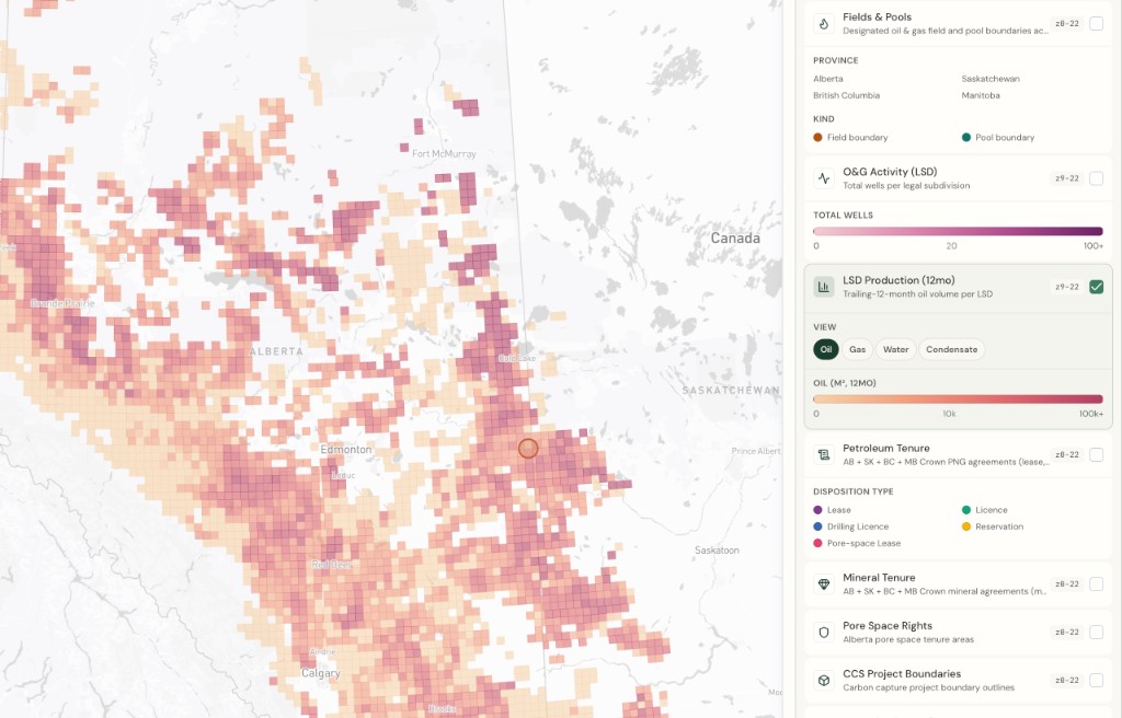
By Township Canada
One Energy Layer Panel Across Four Provinces: Unified, Filterable, and Less Cluttered
Township Canada's energy layer panel consolidates 20 per-province entries into 12 unified layers covering AB, SK, BC, and MB, filterable by Province, Product, Type, and Status.
You're filing a pipeline application that crosses the AB-SK border at Township 10, Range 32 W3M. The route runs through six quarter sections, three in Alberta and three in Saskatchewan. To build the regulatory package, you need to check wells, pipeline crossings, and facilities on both sides of the border, all referenced by DLS legal land descriptions.
Until now, that meant toggling separate layers: Wells (AB), Wells (SK), Pipelines (AB), Pipelines (SK), Facilities (AB), Facilities (SK). Six layer toggles just to see the same three data types across two provinces. Add a third province (say BC wells in the Peace River block) and you're managing nine toggles. The energy panel had 20 per-province entries. Scrolling through them to find the right pair for the right province slowed down work that should take seconds.
That's fixed. The energy layer panel now has 12 unified entries instead of 20, and each entry covers every province where that data exists.
Four unified layers, four provinces
The consolidation covers the four core energy layer types:
Wells: one layer covering Alberta, Saskatchewan, British Columbia, and Manitoba. About 760,000 wells total: 530,000 from the AER in Alberta, 185,000 from Saskatchewan's Ministry of Energy and Resources, 34,000 from the BC Energy Regulator, and 12,000 from Manitoba's provincial registry. All rendered from a single wells.pmtiles archive with a common property contract: province, product_class, status_class, and operator.
Pipelines: one layer covering AB, SK, and BC. About 580,000 pipeline segments: 470,000 in Alberta, 99,000 in Saskatchewan, 6,000 in British Columbia. Manitoba publishes no open pipeline spatial dataset, so MB is not included. Colour encodes the substance (oil, gas, water, multi-phase), and dashed lines mark non-active status.
Facilities: one layer covering AB, SK, and BC. About 135,000 facility sites: 110,000 in Alberta, 8,000 in Saskatchewan, 15,000 in British Columbia. Colour-coded by facility category (battery, compressor, gas plant, injection, meter station, pipeline installation, well site, and other). Manitoba publishes no facility layer either.
Fields and Pools: one layer covering AB, SK, BC, and MB. Alberta oil-gas fields, Saskatchewan designated pools, BC field areas, and Manitoba designated oilfields, all rendered as outlines so the satellite imagery underneath stays visible.
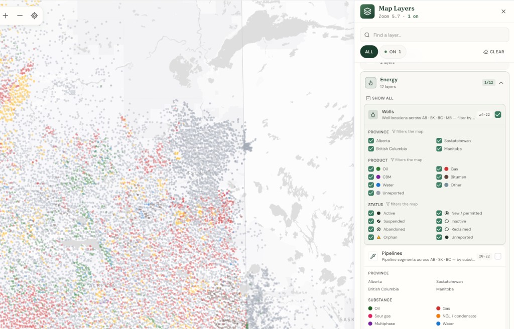
The remaining energy layers (CCS pore space rights, CCS injection wells, CCS project boundaries, geothermal tenure, petroleum tenure, mineral tenure, O&G activity, and LSD production) are unchanged. Those layers either already operated across provinces (petroleum and mineral tenure cover AB, SK, BC, and MB) or are province-specific by nature (O&G activity and LSD production are AER-only datasets).
Filter by Province, Product, Type, and Status
Each unified layer carries normalized properties baked into the tiles at build time: province, product_class, status_class, and (for facilities) facility_class. Those properties drive four filter sections in the legend panel:
Province: toggle AB, SK, BC, or MB on and off. Working only in the Williston Basin? Turn off AB, BC, and MB and the map shows Saskatchewan wells alone. Need the full western Canada picture? Leave all four active.
Product / Substance: filter wells by what they produce (oil, gas, bitumen, water, other) or pipelines by what they carry (oil, gas, water, multi-phase). BC pipelines carry a caveat: the BC Energy Regulator publishes line type but not substance, so every BC pipeline segment sits in the "unreported" bucket.
Type: for facilities, this maps to the facility category: battery, compressor, gas plant, injection, and so on.
Status: active, suspended, abandoned, reclaimed, or (for AB wells) orphan. The orphan flag is Alberta-specific; other provincial regulators don't publish an orphan designation in their spatial data.
These filters compose. A land technician checking a pipeline route across the AB-SK border can show only active wells producing gas in both provinces, one toggle per filter dimension, not six separate layers.
Real-world example: cross-border pipeline regulatory package
Back to the pipeline application crossing the border near Township 10, Range 32 W3M. Here's the workflow with unified layers:
- Enter
10-32-W3in the search box to centre the map on the area. - Toggle on Wells, Pipelines, and Facilities in the energy panel. Three toggles, not six.
- The map renders both AB and SK wells, pipelines, and facilities across the border in one view. Colour tells you the product; dashed lines tell you inactive status.
- Open the Province filter and confirm both AB and SK are active. If you only need the SK side for a moment, toggle AB off.
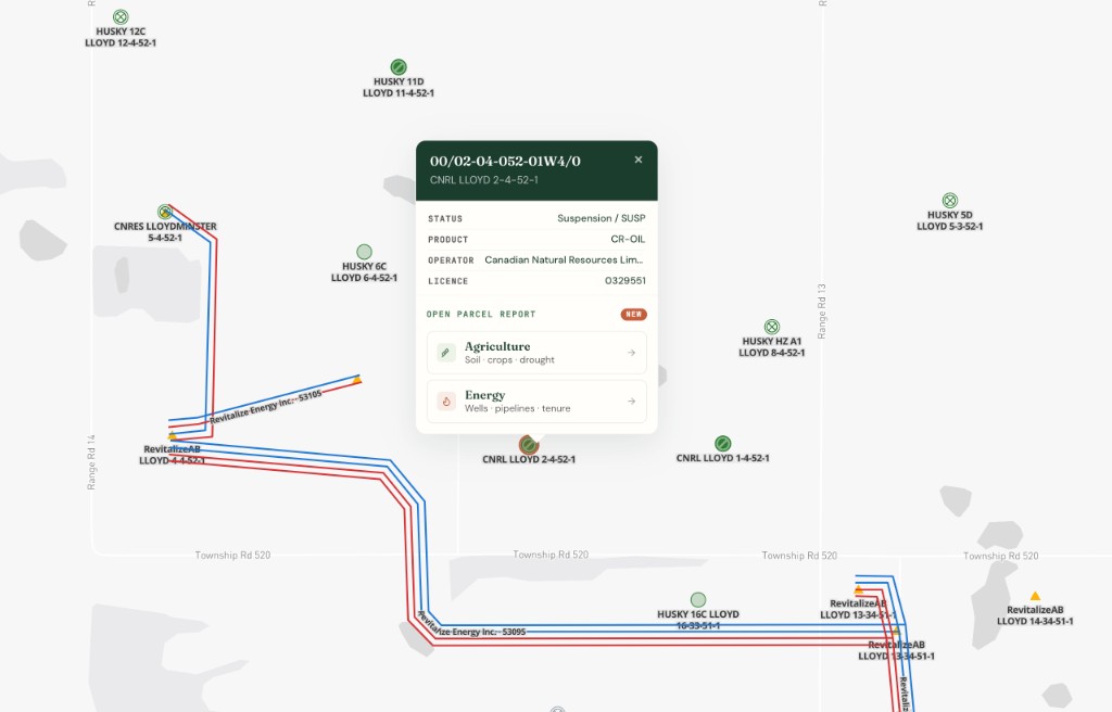
- Click a well on the SK side to open the parcel report sidebar. It shows the same well detail, pipeline crossings, and facility context that the AB report does, drawn from the same unified data.
- Export the view as GeoJSON for the regulatory submission.
No province switching. No reconciling two separate well datasets on two separate screens. The same DLS grid, the same popup format, the same report structure across the border.
What changed under the hood
The per-province layers (Wells (AB), Wells (SK), and so on) were backed by separate PMTiles archives, one per province per layer type. The unified layers are backed by tile-joined archives (wells.pmtiles, pipelines.pmtiles, facilities.pmtiles, og_fields.pmtiles) built in the ETL pipeline. Each feature carries a province property and normalized classification properties (product_class, status_class, facility_class) so the rendering and filtering code works identically regardless of which regulator published the source data.
Popups, parcel report cards, the energy index, and operator drill-down views all reference the unified layer IDs now. If you have a saved map state or a bookmark with old layer IDs, the app maps them to the new unified equivalents automatically.
Getting started
The unified energy layers are part of the Energy Bundle, available on Pro or Business plans at $50 CAD/month. If you already subscribe, the consolidated layers replaced the per-province entries in your map layers panel. No action needed.
If you're new to the Energy Bundle, the oil and gas industry page walks through what it includes. Or open the Township Canada app, toggle on a layer, and see it in action. Free parcel reports are available on every plan so you can test the report sidebar before committing to a bundle.
For a broader look at the multi-province data expansion that preceded this consolidation, see Saskatchewan, BC, and Manitoba Energy and Agriculture Map Layers Are Now Live.