By Township Canada
Bulk DLS to GPS for Insurance: Convert a Book of Rural Policies in One Upload
Convert a rural policy book from legal land descriptions to GPS coordinates with one CSV upload, then join the results back to your exposure model.
A rural insurer's book does not look like a city book. An acreage, a grain farm, and a hobby farm on the prairies are usually on file by legal land description, such as SE-14-032-21-W4 or 06-32-048-07W5, because that is how the land is identified on title. The pricing model, the wildfire and flood overlays, and the catastrophe (CAT) exposure tools all expect a latitude and longitude.
So someone has to convert the book. In many teams that is an analyst pasting descriptions into a converter one row at a time, or a script written years ago that breaks on a missing meridian or an LSD with a leading zero. Either way, the work comes back at every renewal cycle and after every large event. This post walks through doing it as a single batch run in Township Canada, and what to watch for when the results go into a model.
What goes into the file
The batch tool takes a CSV with one location column. Name it legal_land_description (or lld, legal, location, or description) and it is detected automatically. Every other column you include, such as the policy number, line of business, sum insured, and renewal date, is carried through to the export. That matters, because the policy number is the key you will join on later.
The location column can mix systems in one file:
- DLS at any level: LSD (
06-32-048-07W5), quarter section (SE-14-032-21-W4), section, or township - NTS for most of British Columbia, such as
A-2-F/93-P-8 - Ontario lots and concessions, which need the township name, such as
Lot 2 Con 4 Osprey - Manitoba river lots, such as
RL-45-AD(River Lot 45, Parish of St. Andrews)
Each row is parsed on its own, so a book that spans the prairies, BC, and Ontario goes in as one file. A single job takes up to 5,000 rows. Larger books are split into several files and run in turn.
Upload, run, download
Open Batch, choose Upload CSV, and drop in the file. The preview shows which column was picked, the detected direction (Legal to GPS), and the columns that will be preserved. Turn on Administrative Boundaries if your rating territories follow municipal lines: it adds the province and municipality to each row.
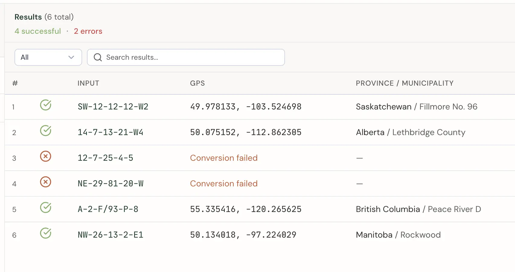
For a policy book, download the Enhanced CSV. It returns every original column, in the original row order, with result columns appended. The ones that matter here:
| Column | What it holds |
|---|---|
_latitude, _longitude | The centre of the described parcel |
_province, _municipality | Administrative context (municipality needs the option) |
_status, _error | Whether the row converted, and why not |
_polygon_wkt | The parcel boundary as well-known text (WKT) |
Because the policy number is still on every row, joining back to the pricing or exposure table is a plain key join. Shapefile and GeoJSON exports are there too if the next step happens in a GIS.
Point or polygon: know what the coordinate means
A legal land description names an area, not a building. The coordinate that comes back is the centre of that area. For an LSD, that is the centre of a 40-acre parcel. For a quarter section, it is the centre of 160 acres, roughly 800 m on a side, and the house, shop, and bins could be anywhere inside it.
This means the right input depends on the question. If you are asking whether a policy falls inside a hail swath or a flood zone, intersect the hazard layer with _polygon_wkt, not the point, so a parcel that is half inside does not get missed. If you need distance to a structure, for example for wildfire defensible space, the centroid is an approximation, and the policy's own location data (or a site visit) is the better source.
Rows that need attention
Not every row in a real book converts on the first pass. Filter the results to errors and check them before the file goes anywhere. The common causes:
- A missing meridian or range.
NE-29-81-20-Wcannot be resolved without the meridian number. - An Ontario lot without its township. Lot and concession numbers repeat across hundreds of townships.
- Free text in the column. Title wording such as "Ptn of" or "except Plan ..." belongs in another column. Keep the location column to the grid reference itself.
The converter does not guess: a row either matches a surveyed parcel or comes back as a failure with _status set to error. That is the behaviour you want feeding a pricing model. Fix the source rows and re-run. Only successful records count toward the batch allowance, and re-running the same list does not count them twice.
Flood and hazard context per parcel
For an individual risk that needs a closer look, the Agriculture add-on's parcel report summarises NRCan flood susceptibility for the quarter section, alongside soils and drought. That is a per-parcel report, with 100 reports a month included in the add-on. Running Agriculture or Energy data across a whole book in batch is an Enterprise service.
When to move from upload to the Batch API
The Business plan includes 2,500 successful batch records per month, shared across your organization. Batch packs add 2,500 records for $100, up to two a month, which covers a book of up to 7,500 policies in a month. A book that is larger, or refreshed in full every month, is an Enterprise conversation. Current prices are on the pricing page.
If the refresh runs on a schedule, the Batch API is the other route. It is a separate subscription that takes up to 100 descriptions per request and returns GeoJSON with both the parcel boundary and the centroid, so a renewal job can re-geocode new and changed policies without anyone opening a browser. For an annual review, the upload is enough. For a book that changes weekly, script it once.
For how claims and adjuster teams use the same conversions after a storm, see how insurance companies use legal land descriptions.