By Township Canada
Batch LSD to GPS: Convert Your Well Site List Before Freeze-Up
Turn a list of well LSDs and UWIs into GPS coordinates in one batch run: build the CSV, fix failed rows, and export to CSV, KML, or Shapefile.
Late fall is when a lot of well lists get worked. A production coordinator has 400 sites to check before freeze-up, a contractor is heading to suspended wells they have never visited, and the spreadsheet that drives it all lists each site the way the licence does: an LSD like 06-32-048-07W5, or a UWI like 100/06-32-048-07W5/00. Nobody in a truck can drive to either. They need a latitude and longitude for every row.
Looking those up one at a time works for ten wells. At 400, it is a day of copying and pasting, and every paste is a chance to transpose a range or a meridian. Batch conversion does the whole list in one run. Here is how to set the file up, what comes back, and what to do with the rows that fail.
Build the input CSV
The batch tool reads a CSV with one location per row. It finds the location column by its header, so name it legal_land_description (or lld, legal, location, or description). Keep every other column you already have: well name, licence number, operator, priority, crew. Those columns ride along with the file and come back in the export.
The location column does not have to be one format. A single file can mix:
- LSDs, written as
06-32-048-07W5,6-32-48-7-W5, or similar - Quarter sections, such as
NE-14-032-21-W4 - AER-style UWIs, such as
100/06-32-048-07W5/00 - BC NTS locations and NTS-based UWIs, for wells in northeastern BC
Each row is detected and parsed on its own, so a list exported from two different systems can go in as it is. One file can hold up to 5,000 rows (5 MB).
A note on UWIs. In Alberta, the location inside a UWI is the bottom hole of the well, not the wellhead. For a vertical well those are the same LSD. For a directional or horizontal well, the bottom hole can sit in a different LSD from the lease your crew drives to. If the list is for site visits, convert the surface location from the well licence. If you have the Energy add-on, its well lists place each AER well by its surface hole (the wellhead), which is a quick way to check a pad. UWI format, explained covers the rest of the identifier.
Upload and convert
Open Batch from the main menu, choose Upload CSV, and drop the file in. Before anything runs, the preview shows the column it picked, the direction it detected (Legal to GPS), the first few values, and the extra columns it will keep.
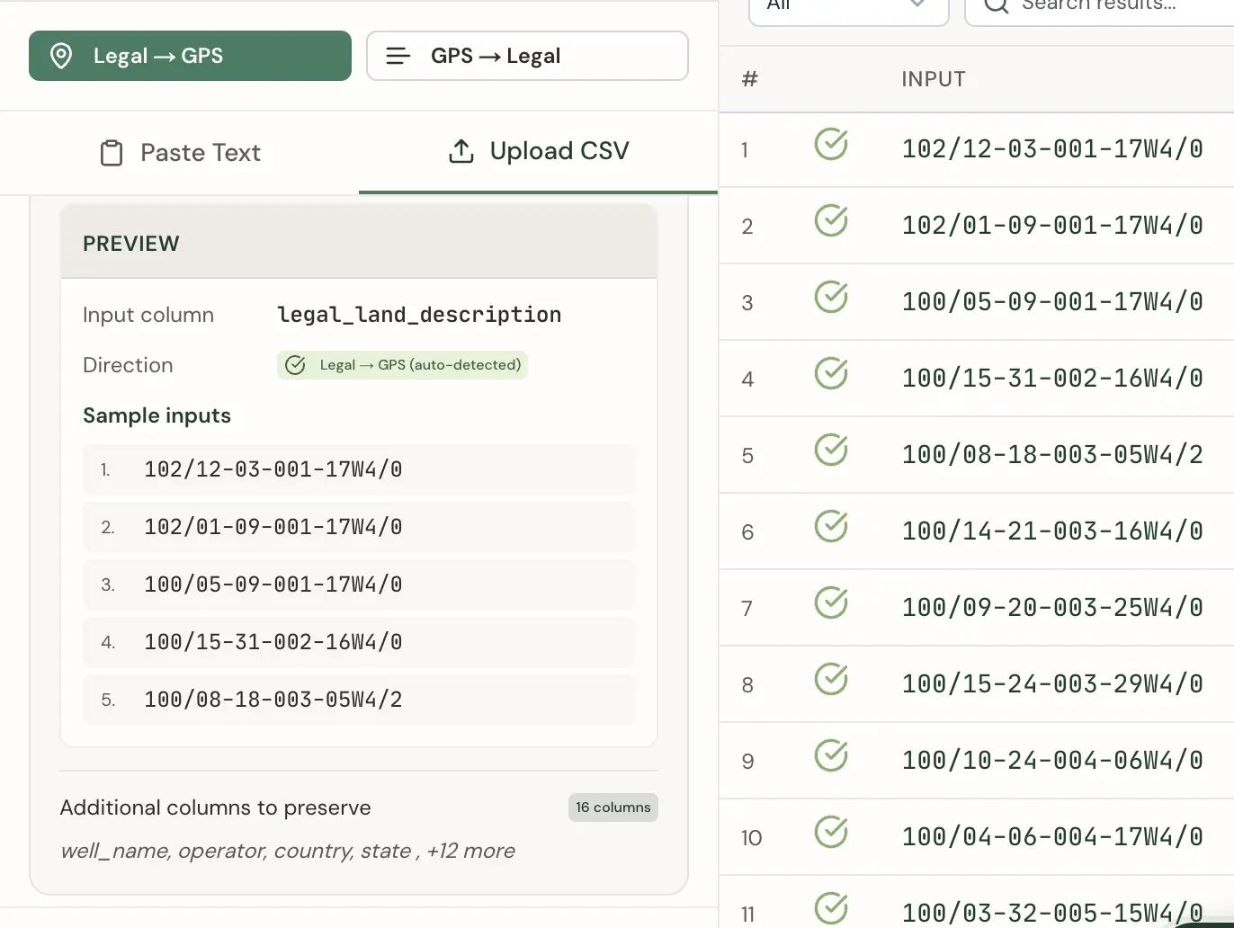
You can add enrichment before converting. Administrative Boundaries adds the province and municipality, which helps when sites are split between crews by county. Oil & Gas Fields adds the field name for each location. Then run the conversion. Results appear in a table and as points on the map, so you can see at a glance whether anything landed far from the rest of the list.
Check the rows that fail
Every row comes back as a success or a failure. Filter the table to errors before you export anything. In a well list, the usual causes are:
- A missing meridian.
NE-29-81-20-Whas no number after the W, so there is nothing to match. - A value outside the grid. LSDs run 1 to 16 and sections run 1 to 36. An LSD of
17or a section of40is a typo upstream. - A truncated or merged cell. Spreadsheet exports sometimes drop leading zeros or join two columns. Compare the input to the licence.
Fix the source rows, then convert only the corrected rows as a second, smaller file. Only successful records count toward the Business allowance, so the rows that failed the first time cost nothing. Re-submitting the identical file on the same day, for example after a timeout, is not counted twice. However, a file with edited rows is a new submission, so re-running the whole list would count every successful row again. The LSD system page is a useful check when a number looks wrong.
Get the coordinates to the field
The export you pick depends on where the list goes next:
- Enhanced CSV keeps every original column and appends
_latitude,_longitude,_province,_municipality,_oil_gas_field,_soil_type,_status,_error, and_polygon_wkt. This is the one to send back to the person who owns the spreadsheet, because nothing is lost. - KML opens in Google Earth, which is a simple way to share the list with a contractor.
- Shapefile, GeoJSON, and DXF load into GIS and CAD tools.
You can also save the results to a Project so the list stays in your account. For the day itself, the route planner orders up to 12 stops per optimization, which turns a cluster of nearby sites into a sensible day of driving.
Allowance and timing
Batch conversion is part of the Business plan, which includes 2,500 successful batch records per month, shared across your organization. A 400-well list fits with plenty of room. If year-end work pushes you past that, batch packs add 2,500 records for $100, up to two per month. Teams that run more than that every month belong on Enterprise. Current prices are on the pricing page.
If you rebuild the same list every season, you can also script it. The Batch API is a separate subscription that takes up to 100 legal land descriptions per request and returns GeoJSON, so a scheduled job can refresh the coordinates whenever the well list changes. For a one-time list this fall, the upload is faster. For a list you will convert again next year, the API call is worth setting up once.
For a related workflow, see batch conversion for well closure filings, which covers Directive 013 and 079 submissions.