
By Township Canada
Mapping CCS Pore Space and Geothermal Tenure in Alberta Before a Development Screen
Screen an Alberta site for CCS pore space and geothermal tenure on the DLS grid, next to wells, pipelines, and Crown tenure, before the development plan.
A carbon storage or geothermal project in Alberta can fail its first review for a reason that has nothing to do with geology. The candidate site already sits inside someone else's pore space agreement, or a geothermal lease, or above a cluster of old wellbores that cut through the target formation. None of that shows up in a reservoir model. It shows up when someone overlays the tenure records on the survey grid, usually later than they would like.
This post walks through that overlay in Township Canada: what the CCS pore space and geothermal tenure layers show, how they relate to the DLS grid, and how to run a quick pre-development screen on a candidate LSD before the team commits to a site.
Why tenure comes before the development plan
In Alberta, the Crown owns pore space. The province grants the right to store CO2 in it through carbon sequestration tenure, and it grants geothermal rights through a separate tenure of their own. The AER regulates the wells and injection schemes that use those rights. Two practical questions follow for any new project. Does existing CCS or geothermal tenure already cover the ground you want? And what conventional oil and gas activity sits on the same ground?
The second question matters as much as the first. A storage site with old wells through the caprock, an active pipeline corridor, or Crown petroleum and natural gas (PNG) rights held by another company will need more work before it is a clean candidate. Answering both questions early is cheaper than finding the conflict after a site has been chosen.
What the CCS layers show
Township Canada carries three CCS layers for Alberta, published by the Government of Alberta. Each one has its own toggle in the Energy category of the layers panel:
- Pore Space Rights: pore space tenure areas, drawn as indigo polygons.
- CCS Project Boundaries: the outlines of named carbon capture projects.
- CCS Injection Wells: CO2 injection well locations, styled apart from production wells.
CCS records carry the feature type, name, operator, status, area, and effective and expiry dates. Injection wells carry their name, licence number, operator, status, and well type. All three layers are free on every plan. You do not need the Energy add-on to see them on the map.
The CCS tenure data source page covers the dataset in more detail. If your next step is a tenure application rather than a screen, identifying quarter sections in CCS tenure zones walks through building the quarter section list and the GeoJSON exhibit.
What the geothermal layer shows
The Geothermal Tenure layer shows Alberta's provincial geothermal tenure polygons in orange. Each agreement carries its name, operator, status, tenure type, and area. Like the CCS layers, it is free on every plan and covers Alberta only.
Geothermal and CCS projects often look at the same deep formations in the same sedimentary basin that holds oil and gas. Turning on Pore Space Rights and Geothermal Tenure together shows where the two tenure types sit relative to each other, on the same DLS grid as the wells and pipelines.
Running a pre-development screen on one LSD
Say your team has a candidate injection site and wants a first look before it goes into the development plan. The screen takes four steps.
First, search for the site's legal land description, such as 06-32-048-07W5, to put the map on that LSD. Then turn on Pore Space Rights, CCS Project Boundaries, CCS Injection Wells, and Geothermal Tenure, and zoom out a township or two to see whether the site sits inside, beside, or clear of existing tenure.
Next, add the Wells layer. It is free and covers all four western provinces. In Alberta, wells carry AER status and the Orphan Well Association orphan flag, so you can see abandoned and orphan wellbores near the site at a glance.
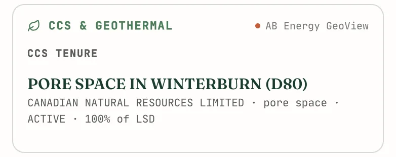
Finally, with the Energy add-on, click inside the LSD and open the Energy tab of the parcel report. The CCS & geothermal card lists every CCS tenure feature, geothermal agreement, and CO2 injection well that intersects the LSD, with its operator, type, status, and the share of the LSD it covers. Select an item and the map turns on its layer and flies to it.
The rest of the Energy tab fills in the conventional picture for the same LSD: wells with their status, pipeline crossings with substance and H2S content, facilities, 12-month production, and the Crown PNG and mineral dispositions that intersect it, with expiry dates. An LSD with no oil and gas activity still returns a report when Crown, CCS, or geothermal tenure intersects it. Each Alberta well also opens with a subsurface view of the formations around it. That view gives useful context for a storage target, but it is not built for drilling or storage decisions.
The Energy add-on costs $180 a month or $1,800 a year on top of a Pro or Business plan and includes 100 parcel reports a month. One report is one parcel in one month, so reopening the same LSD does not count again. The Energy add-on guide explains each card.
What this screen does not replace
This is a screening tool. The Government of Alberta's tenure records and the AER remain the authoritative sources for any regulatory filing, and the tenure layers update as the province publishes new data. CCS and geothermal tenure are still growing in Alberta, so a clear result today may not hold for a site you file on next year.
Coverage is also limited to Alberta. Saskatchewan, British Columbia, and Manitoba have no CCS or geothermal tenure layer in Township Canada, although wells and Crown tenure cover all four provinces.
For environmental consultants who run screens like this for several clients, the environmental consulting guide covers the wider legal land description workflow, and the CCS and geothermal developers page lists every layer in one place.