By Township Canada
How to Screen a Quarter Section for Nearby Wells and Abandonments Before a Field Visit
Check which wells sit on or next to a quarter section, and which are abandoned or orphaned, by legal land description before you drive out.
Before a site visit, a surface lease review, or an AER Directive 056 application, someone has to answer a plain question: which wells sit on this quarter section or right next to it, and what state are they in? A suspended well on the next quarter changes the access plan. An abandoned wellbore inside the lease boundary changes the conversation with the landowner. An orphan well nearby means the closure work belongs to a different party than you might assume.
The answer usually exists. It is just spread across tools that do not share a key.
The usual round trip
The common path starts in AER OneStop or a well list. You find a well, copy its unique well identifier (UWI), paste it into a converter to see which quarter section it is in, and then repeat for every well that might be close to the parcel. Status sits in another column, and abandonment or orphan status may come from a different source again. By the fifth well, it is easy to lose track of which ones you already checked, and a well just across the section line is the one most likely to be missed.
The fix is to start from the land instead of the well list. If the quarter section is on the screen with every well around it plotted on the survey grid, proximity is something you see rather than something you reconstruct.
Step 1: Find the quarter section
Type the legal land description into the search box. Township Canada accepts quarter sections such as NW-36-42-3-W5 and LSDs such as 10-36-42-3-W5, written with dashes or spaces between the parts. Select the result, and the map zooms to the parcel with the DLS grid drawn around it, so the neighbouring quarters and LSDs are labelled in the same view.
Step 2: Turn on the Wells layer
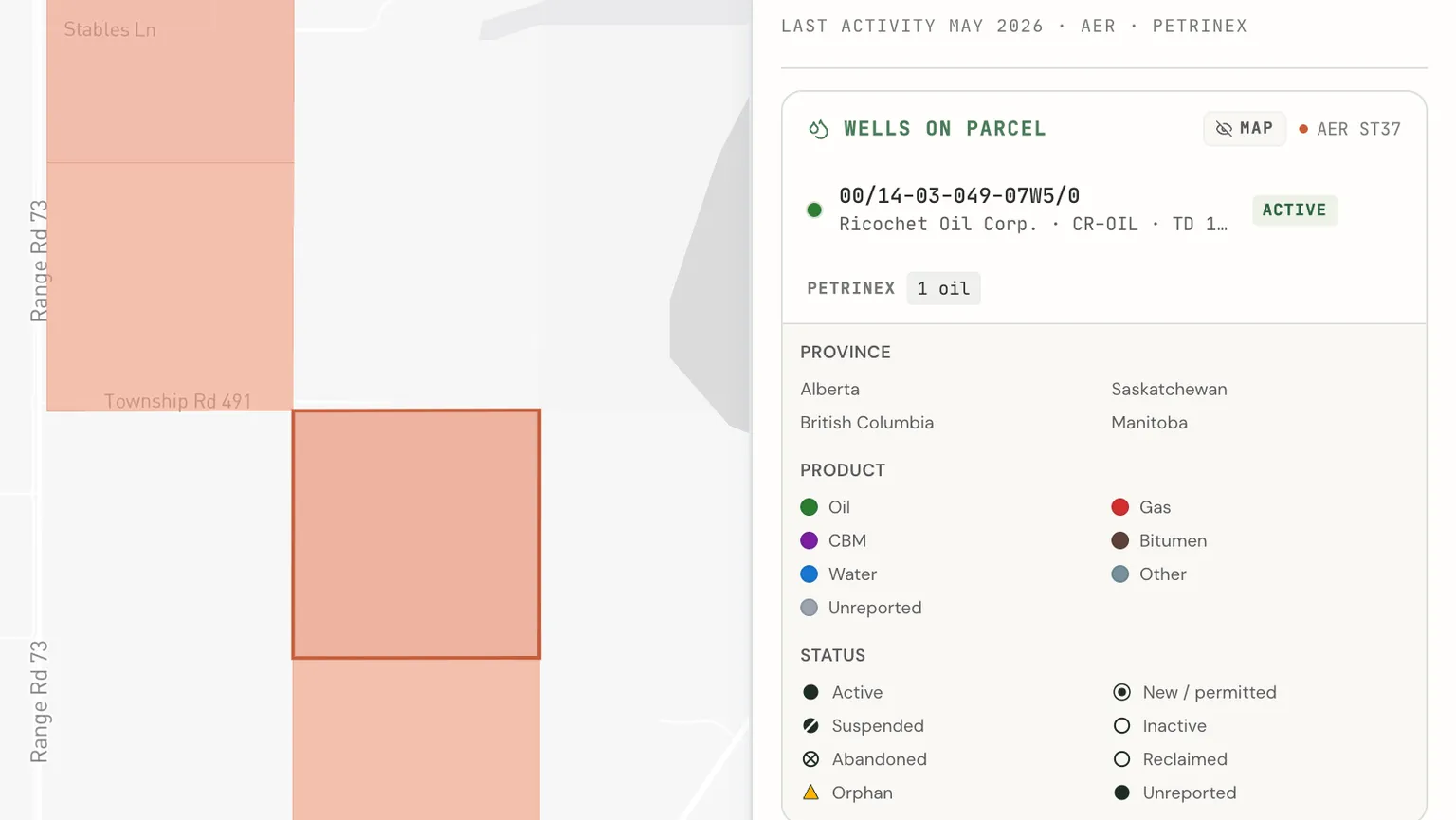
Open the Layers panel and turn on Wells. The layer plots well locations across Alberta, Saskatchewan, British Columbia, and Manitoba. Colour shows the product (oil, gas, water, and so on) and the marker shape shows the status. Orphan wells are drawn as amber triangles, so they stand out at a glance. On the map, the orphan flag is shown for Alberta wells only.
The legend doubles as a filter. Clear every status except abandoned and orphan, and the map shows only the wells that matter for a liability check. Because the layer covers the whole map, the wells on the adjacent quarters are already in view. That is the proximity check: look at the quarter, then look one quarter out in each direction.
Click any well for its popup. The header shows the UWI and the well name, and the body lists the status, product, operator, licence number, and province.
The Wells layer is free on every paid plan, so this first pass needs no add-on.
What abandoned and orphan mean for your review
The two flags are easy to mix up, and they point to different follow-ups.
- Abandoned is a regulatory state. The well has been plugged and closed, and the licence is no longer active. A well can be abandoned and still be someone's responsibility.
- Orphan is a financial state. The licensee can no longer meet its closure obligations, and the well is in the Orphan Well Association inventory.
For a surface lease review, an abandoned well tells you there is a wellbore and a former lease footprint to account for. An orphan well tells you the party handling its closure is no longer the original licensee. The orphan and abandoned wells page explains where each flag comes from. Both flags cover Alberta, Saskatchewan, and British Columbia; Manitoba is not covered yet. If you work on closure files, the well abandonment guide covers the legal land description side of that work.
Step 3: Search a specific well by UWI
When you already have a UWI from a licence, a landowner letter, or an AER notice, paste it straight into the search box, for example 00/12-23-062-21W5/0. The well appears in place on the DLS grid, so you can see which quarter section and LSD it sits in. This is the fastest way to confirm whether a well named in a document is actually on the parcel you are reviewing or on the one beside it. For how the UWI encodes the location, and how to convert a list of them, see UWI to GPS.
Step 4: Read the LSD detail in the parcel report
The map gives you the picture. For a record you can file, open the parcel report and go to the Energy tab. This needs the Energy add-on. The status summary counts the wells by lifecycle (active, suspended, abandoned, orphan), and the Wells card lists each well with its UWI, operator, fluid, total depth, and status. For an Alberta well, click a row to open its detail. Use the pin icon on any row to fly the map to the well.
Energy data is held at the LSD level. If you need the detail for a particular corner of the quarter, open the report for that LSD. Reports are counted by quarter section, so opening the LSDs inside one quarter counts as a single report against your monthly allowance.
The add-on also adds the O&G Activity (LSD) layer and a liability preset that shades each LSD by its orphan well count. That is useful when you are screening a block of land rather than a single quarter.
Step 5: Capture it for the file
From the Energy tab, select the PDF button to build the Energy Parcel Report PDF. It carries the wells, pipelines, facilities, and tenure for the parcel with the source on each section, plus a short written summary. When you build it for a quarter section without naming an LSD, the energy detail comes from the most active of the four LSDs, and the PDF says which LSD it shows. For a regulatory package or a field folder, that page is the record of what the public registers showed on the day you checked.
What you need
The Wells layer comes with any paid plan. The Energy tab, the Energy Parcel Report PDF, and the gated energy layers are part of the Energy add-on (the Energy Bundle), which stacks on a Pro or Business plan for $180 CAD a month or $1,800 a year, with 100 parcel reports a month. The oil and gas data pages show the same well data organized by field, operator, and township if you want to look around before you sign up.