By Township Canada
BC Land Surveyors: How to Get Every Registered Parcel in an NTS Grid Cell
Enter a BC NTS grid reference in Township Canada and get every registered ParcelMap BC parcel back: PID, plan number, area, centroid, and boundary polygon.
You have a map sheet reference, 092G06, and a client who needs a subdivision plan tied to every registered parcel within it. Before the survey crew drives to the site, you need to know how many parcels sit inside that NTS cell, what their PIDs are, and where the boundaries fall relative to the terrain. That means pulling data from two systems that do not share a coordinate language: the federal NTS grid and the provincial ParcelMap BC registry.
The usual approach is to open Natural Resources Canada's NTS index to locate the map sheet, then switch to the LTSA's ParcelMap BC portal, then manually compare the two views to figure out which parcels fall inside the grid cell. Two portals, two reference systems, and a GIS step in between if the project involves more than a handful of parcels.
Township Canada's BC NTS parcel lookup collapses that into a single search. Enter the NTS reference, and it returns every registered ParcelMap BC parcel that intersects the grid cell.
What the lookup returns
Each parcel in the result set includes:
- PID: the nine-digit Parcel Identifier registered with the BC Land Title Office
- Plan number: the survey plan under which the parcel was registered
- Area: parcel size in square metres
- Centroid coordinates: GPS coordinates for the centre of the parcel
- Boundary polygon: the full registered boundary geometry, viewable on the map or exportable
The data comes from ParcelMap BC, the Land Title and Survey Authority's official registry of titled parcel boundaries. Township Canada resolves the NTS reference to its geographic extent and runs a spatial query against that dataset. The result is the complete set of fee simple parcels within the grid cell, rendered on the map alongside the NTS grid overlay and satellite imagery.
Walkthrough with 092G06
A BC land surveyor preparing a legal survey plan for a forestry road right-of-way in the Fraser Valley needs to identify all titled parcels that the road corridor crosses. The corridor runs through NTS map sheet 092G06, covering an area northeast of Chilliwack.
Step 1. Open the BC NTS converter and enter 092G06.
Step 2. The map zooms to the sheet boundary. The ParcelMap BC layer shows the registered parcel boundaries within the cell.
Step 3. Click any parcel polygon to see its PID, plan number, area, and centroid. For the right-of-way survey, the PIDs identify which titles need to be searched at the Land Title Office, and the plan numbers point to the existing survey plans that the new plan must reference.
Step 4. To narrow the area, enter a block-level reference like 092G06-B. The spatial query returns only parcels that intersect block B, filtering out the rest of the sheet.
The same logic works at every NTS precision level. A sheet reference returns all parcels within the sheet. A block reference narrows the set. A unit or quarter-unit reference narrows it further. The finer the NTS reference, the smaller the parcel set.
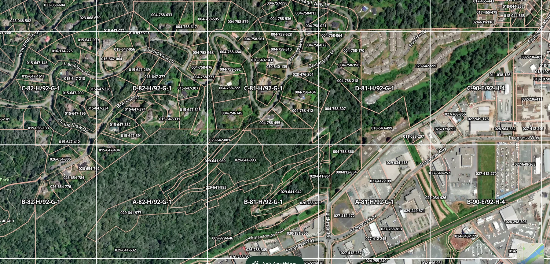
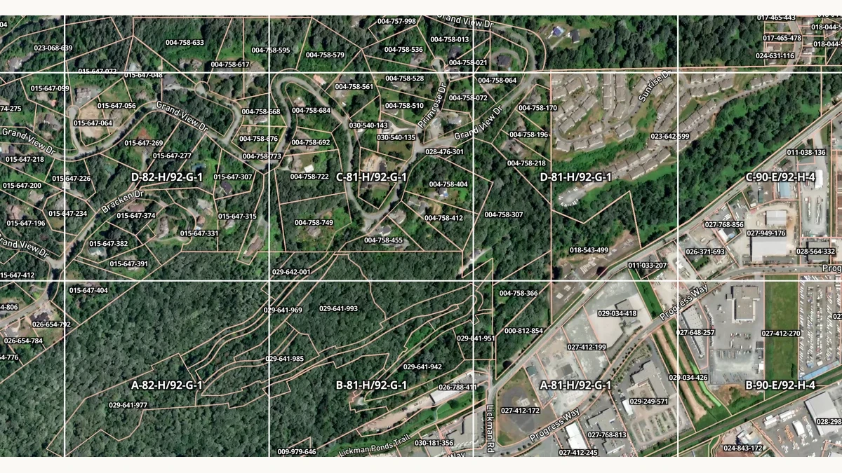
ParcelMap BC boundaries and PID labels over the NTS grid near Chilliwack, captured September 29, 2026. This view shows the map overlay; it is not the 092G06 lookup response.
Where this fits in survey workflows
Pre-survey parcel identification
Before mobilizing a crew, surveyors need to know which titled parcels are affected by the work. A subdivision survey, a right-of-way plan, or a boundary retracement all start with a list of PIDs. Traditionally, building that list meant downloading the ParcelMap BC shapefile (a multi-gigabyte dataset), loading it into a GIS, and running a spatial intersection with the NTS sheet boundary.
The NTS parcel lookup replaces that step. Enter the grid reference, get the PID list. The plan numbers in the results point to the existing survey plans that need to be examined before field work begins.
Reference plan cross-checking
When preparing a new survey plan, a BC land surveyor needs to identify every existing plan that touches the survey area. The plan numbers returned by the parcel lookup provide that list directly. Rather than searching the LTSA's plan database one parcel at a time, the surveyor gets every relevant plan number in a single query and can start the title search immediately.
Crown land boundary context
Not every parcel in a grid cell is fee simple. The gaps between titled parcels are often Crown land, and identifying those gaps matters for forestry road permits, mineral exploration access, and Crown land referrals. Seeing the titled parcel boundaries overlaid on the NTS grid makes it clear which portions of the grid cell are titled and which are not, without requiring a separate Crown land query.
Export and plan preparation
Parcel boundaries from an NTS lookup export in multiple formats: GeoJSON and Shapefile for import into ArcGIS Pro or QGIS, KML for field navigation, CSV for parcel lists and title search scheduling, DXF for CAD environments used in plan drafting, and PDF for formatted summary reports. PDF export requires Pro or higher. CSV, KML, GeoJSON, Shapefile, and DXF require Business. Full details are on the pricing page.
One search instead of three tools
BC land surveyors routinely translate between the NTS grid and the provincial parcel registry. The NTS parcel lookup puts both reference systems in one view: enter a grid reference, see the registered parcel boundaries, get the PIDs and plan numbers for the title search. That is the step between receiving the NTS reference from the client and starting the field work, and it no longer requires a GIS intersection or a second portal.
The BC parcel lookup is available on Pro ($20/mo) and above. For more on how Township Canada fits into survey workflows across all Canadian survey systems, see How Professional Surveyors Use Legal Land Descriptions. Try the parcel lookup with 092G06 on the BC NTS converter, or with any NTS reference that covers your next survey area.