By Township Canada
Ontario Lot and Concession System Explained: How to Convert to GPS Coordinates
How Ontario's lot and concession system works, how it differs from the western DLS grid, and how to convert lot-concession-township descriptions to GPS.
You're reviewing a rural property title in Dufferin County, and the legal description reads Lot 15, Concession 3, Township of Amaranth. No township number. No range. No meridian reference. If you've spent your career working with Alberta or Saskatchewan land descriptions, this format is unrecognisable - because Ontario uses an entirely different survey system.
Ontario's lot and concession system predates the western Dominion Land Survey by nearly a century. It covers every rural property in the province, from farmland in the Grand River valley to mining claims in the Sudbury Basin. This guide explains how the system works, breaks down each component of an Ontario legal land description, and shows how to convert any lot-and-concession reference to GPS coordinates.
Ontario's Geographic Township System
Ontario was surveyed before the prairies. Starting in the 1780s, British colonial administrators divided the province into named geographic townships - Amaranth, Adjala, Thurlow, Ops, McNab - each covering roughly 100 square kilometres of territory. Unlike the numbered townships in Alberta and Saskatchewan, every Ontario township has a proper name.
These named townships are the foundation of every Ontario legal land description. Without the township name, a lot and concession number is meaningless - "Lot 15, Concession 3" could refer to parcels in hundreds of different townships across the province. The lots and concessions system guide covers the full structure in detail.
Anatomy of an Ontario Legal Land Description
An Ontario description has three required components:
Lot number - identifies the specific parcel within a concession. Lots are numbered sequentially from one side of the township to the other, typically running east-west. In most southern Ontario townships, each lot covers roughly 80 to 200 acres.
Concession number - identifies the strip of land within the township. Concessions are long bands running across the township, numbered outward from a baseline - usually a lake shore, river, or major road. Most townships have 7 to 14 concessions.
Township name - the named geographic township from the original Crown survey. This is the critical identifier that makes the description unique.
A complete description reads:
Lot 15, Concession 3, Township of Amaranth, County of Dufferin
You'll also see abbreviated forms in documents: Lot 15 Con 3 Amaranth, L15 C3 Amaranth Twp, or Pt Lot 15 Con III Amaranth (where "Pt" means a portion of the lot and Roman numerals sometimes appear in older records).
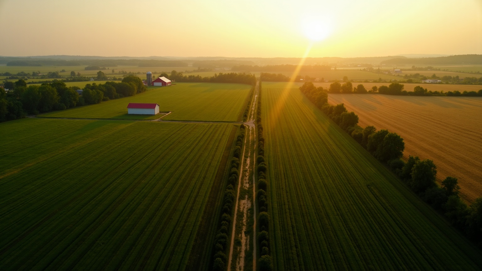
Real Example: Lot 15, Concession 3, Amaranth Township
Enter Lot 15, Concession 3, Amaranth into the Ontario Geographic Township Converter. The result places the parcel in central Dufferin County, northwest of Orangeville.
This is rolling farmland in the Headwaters region of Ontario. A real estate agent listing a rural acreage here would find this description on the property title, in the deed history, and on the MPAC (Municipal Property Assessment Corporation) roll. A surveyor conducting a boundary survey would reference the same lot and concession against the original Crown survey plans held at the Surveyor General's office.
The description tells you the parcel is in the 3rd concession strip from Amaranth's baseline, and is the 15th lot along that strip. The concession width and lot depth vary by township, but in Amaranth a standard full lot is about 200 acres - larger than a single 160-acre DLS quarter section, but well short of a 320-acre half-section.
How Ontario's System Evolved from the Crown Land Survey
The lot and concession system grew out of practical necessity. After the American Revolution in the 1780s, the British government needed to settle thousands of Loyalist refugees on land in what was then Upper Canada. Surveyors worked outward from Lake Ontario and the St. Lawrence River, laying out townships as they went.
Each surveyor adapted to local terrain. In flat agricultural areas like the Grand River valley and the Holland Marsh, concession lines are straight and regular. Along the Canadian Shield - with its lakes, rock outcrops, and irregular shorelines - township boundaries and concession lines bend to follow the terrain. This is why Ontario townships are not all the same size or shape.
The surveying continued for over a century. Southern Ontario was largely complete by the 1860s. Northern Ontario townships were surveyed later, often in response to mining discoveries - the Sudbury Basin in the 1880s, the Cobalt silver rush in 1903, the Timmins gold camp in 1909. Each wave of surveying added named townships with their own internal lot-and-concession grids.
By contrast, the Dominion Land Survey was designed decades later as a single, province-spanning grid - consistent from the US border to the Peace River country. Ontario's system was never intended to be uniform. It was built township by township, and the variation is permanent.
Key Differences from the Western DLS/LSD System
If you work with legal land descriptions in both Ontario and the prairies, these are the differences that matter most:
| Feature | Ontario | Western DLS |
|---|---|---|
| Township identity | Named (e.g., Amaranth) | Numbered (e.g., Township 48) |
| Province-wide grid | No - each township independent | Yes - continuous grid |
| Standard parcel size | ~100-200 acres (varies) | 160 acres (quarter section) |
| Subdivision unit | Lot and concession | Section, quarter section, LSD |
| Meridian reference | None required | Required (W1 through W6) |
| Coverage | Ontario only | AB, SK, MB, Peace River BC |
The biggest practical difference: in the DLS, a description like NE-14-032-21-W4M is globally unique without any additional context. In Ontario, you always need the township name. "Lot 15, Concession 3" means nothing on its own - it could be in Amaranth (Dufferin County), Adjala (Simcoe County), or dozens of other townships.
Prairie professionals moving to Ontario projects regularly trip on this. The reverse is also true: Ontario land professionals encountering DLS descriptions for the first time often don't recognise the meridian reference or the section numbering pattern.

How to Convert Ontario Lot and Concession to GPS Coordinates
Converting an Ontario description to GPS coordinates is straightforward:
- Collect the full description. You need all three parts: lot number, concession number, and township name. If the source document includes the county or district, note it - it helps resolve townships with similar names.
- Enter the description. Go to the Ontario Geographic Township Converter and type the description. The converter accepts standard forms (
Lot 15, Concession 3, Township of Amaranth), abbreviations (Lot 15 Con 3 Amaranth), and short forms (L15 C3 Amaranth). - Review the result. The converter returns GPS coordinates (latitude and longitude in decimal degrees) and places the parcel on an interactive map. Pan and zoom to verify the location against roads, rivers, or landmarks you recognise.
- Use the coordinates. Copy the GPS coordinates for field navigation, GIS import, a title report, or an MLS listing. On Pro plans and above, satellite imagery helps you visually confirm the parcel boundaries.
For multiple descriptions - say, a list of 30 lots from an estate settlement or a title search across a township - the batch converter processes them all at once from a CSV upload (Business plan required).

Common Ontario Township Names and How to Find Them
Ontario has hundreds of geographic townships. Some names you'll encounter often:
Southern Ontario (Simcoe, Dufferin, Grey, Wellington, Renfrew counties): Adjala, Amaranth, Artemesia, Innisfil, McNab, Mulmur, Oro, Osprey, Proton, Thurlow, Tyendinaga.
Eastern Ontario (Hastings, Lennox, Frontenac, Leeds, Lanark counties): Camden, Kaladar, Kennebec, Loughborough, Palmerston, Rawdon, Sidney, South Crosby, Sheffield.
Northern Ontario (Sudbury, Cochrane, Algoma, Thunder Bay districts): Capreol, Creighton, Garson, Neelon, Nickel Centre, Tisdale (Timmins), Whitney (Porcupine gold camp).
If you're unsure of the exact township name - common with older documents or handwritten records - try entering a partial name. Township Canada's search tool suggests matches as you type, so entering "Lot 15 Con 3 Amar" is enough to find Amaranth.
Historical township names that changed during municipal amalgamation can cause confusion. Many townships were merged into larger municipalities in the 1990s and 2000s - Nickel Centre became part of Greater Sudbury, Ops became part of Kawartha Lakes. The geographic township name from the original survey is still the one used in legal descriptions, not the current municipality name.
Real Estate and Surveying Use Cases
Rural Real Estate
Every rural property transaction in Ontario touches the lot and concession system. A real estate agent listing a 100-acre farm near Shelburne needs the legal description from the title - say, Lot 22, Concession 5, Melancthon Township - to accurately represent the property. Buyers doing due diligence need GPS coordinates to confirm access roads, check zoning, and assess the land before making an offer.
Title examiners trace ownership chains through Ontario's land registry, where records are indexed by lot, concession, and township. A severance application - splitting one lot into two parcels - requires the parent lot description and a registered plan of survey. For more on how legal land descriptions fit into property transactions, see the real estate guide.
Land Surveying
Ontario Land Surveyors (OLS) work with lot and concession descriptions on nearly every project. Boundary surveys, subdivision plans, reference plans, and right-of-way surveys all begin with the lot-and-concession description from the original Crown survey. Surveyors reference the original survey field notes - stored at the Surveyor General's Office in Peterborough - to locate original survey monuments and re-establish boundary lines.
Converting lot-and-concession descriptions to GPS coordinates is a routine first step in survey planning: it tells the surveyor where to start field work. For more on how legal land descriptions fit into survey workflows, see the surveying guide.
Mining Exploration
Northern Ontario mining companies register claims using the geographic township system. An exploration geologist working the Sudbury Basin needs to convert claim locations - Lot 4, Concession 7, Creighton Township - to GPS coordinates for drill collar placement, ground-truthing geophysical surveys, and NI 43-101 technical reporting.
Start Converting Ontario Descriptions
Enter any Ontario lot and concession description into the Ontario Geographic Township Converter and get GPS coordinates in seconds. Try Lot 15, Concession 3, Amaranth to see the Dufferin County example from this guide, or type in any description from your own titles, deeds, or survey plans.
For a deeper look at the system structure, read the Ontario province guide. For the technical details of how lots and concessions are organized within each township, see Ontario Lots and Concessions Explained.