Free Legal Land Description Converter for Canada
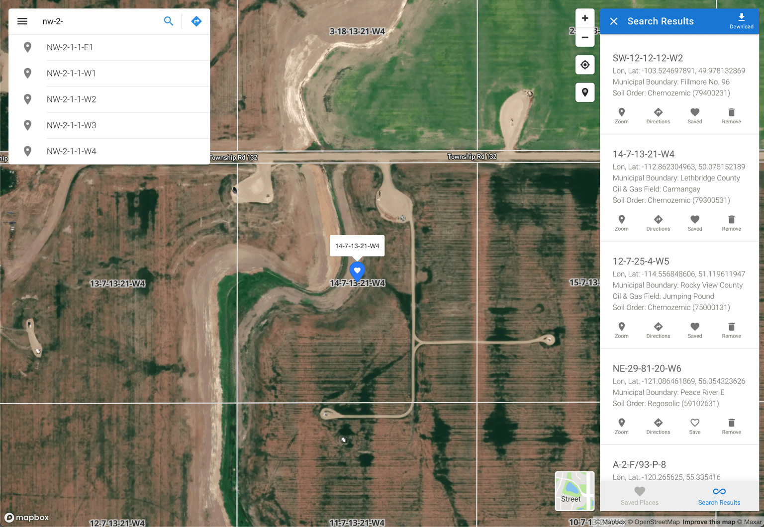
Convert DLS, LSD, NTS to latitude/longitude coordinates in seconds. Find and locate land parcels, properties, and rural locations across Alberta, Saskatchewan, Manitoba, BC, and Ontario.

The leading location converter for Canadian legal land descriptions
Search by legal land description, GPS coordinates, or address. Get instant results with our land location finder.
- DLS Converter
- Convert Dominion Land Survey descriptions to GPS coordinates for Alberta, Saskatchewan, Manitoba, and BC Peace River.
- Learn more
- LSD to Lat/Long
- Convert Legal Subdivisions to latitude and longitude coordinates with reverse geocoding support.
- Learn more
- NTS Converter
- Convert National Topographic System descriptions to coordinates for British Columbia.
- Learn more
- Ontario Townships
- Convert Geographic Township, Concession, and Lot descriptions for Ontario properties.
- Learn more
- Batch Conversion
- Convert thousands of legal land descriptions to coordinates at once with CSV, KML, and Shapefile export.
- Learn more
- Developer API
- Integrate legal land description lookups into your applications with our RESTful API.
- Learn more
Boost your productivity.
Start using our app today.
Explore fast and intuitive solutions for your mapping and data conversion needs. Save time and money; focus on what matters to your business.
See what our customers are saying
Discover how professionals in oil & gas, agriculture, surveying, real estate, insurance, and more, are leveraging our tool for success.
As someone working in the oil and gas industry, I've found Township Canada to be incredibly helpful. It was easy to add their system to ours, and their clear pricing and fair costs are a big plus. It's become an essential part of our everyday work.

I've just discovered Township Canada and have been exploring the services. Fantastic, so far!

Our team absolutely loves your platform! It's become a key part of our daily routine. We find ourselves using it all the time.

Fantastic! Your API is exactly what we needed. Big thanks from our team!

I've been using it since January, and honestly, it's been impressive. Whether it's locating assets or just getting the lay of the land, planning my day in the field, Township Canada makes everything so much smoother and easier. I've even told my friends about it, spreading the word on how useful it is across different fields. Making it easy and something really useful for folks in so many different fields. Definitely a must-try for anyone looking to streamline their mapping and legal descriptions.

We've been on the hunt for a reliable API service that can handle Canadian LLD boundary info, and your API is a perfect fit. It seems to tick all the boxes for what we need. Really excited to integrate it into our system!

I've spent years researching my family history, especially in Ontario, but always found it challenging when it came to land research in Western Canada. Your website is a breakthrough for my research, making it significantly easier to explore locations out West. It's a valuable tool for anyone delving into their family roots.

I want to thank you for the significant role your service played in my research for my debut novel. It's a tale of my ancestor's emigration to Canada in the 19th century. Your tool made navigating the complexities of historical research much simpler.

Huge thanks for the API! It's been a real game-changer for us in the insurance sector. The data quality is excellent, it works great, and it's affordable. Our clients are really happy with our apps!

Setting up accounts for our team was super easy thanks to the centralized billing. It's way simpler than making individual payments. Features like batch conversion and travel time calculation save us a lot of time. It's been a really smooth and efficient process.

We've been using your tool to find lands and locate farms in SK and MB, and it's been fantastic. Our team has found it incredibly useful for our work.

Your platform has been a huge help for us! The ability to do batch mapping and quickly convert DLS to latitude and longitude has made our work much easier and faster. It's exactly what we needed to handle our data efficiently.

Simple pricing, for everyone
Find the right plan for your team, whether you're just getting started or scaling up.
Lite
For personal use and initial exploration.
Free
Get started today- Browse Canadian survey grid maps up to zoom level 14.
- Access street maps featuring roads, boundaries, and natural features.
- Perform up to 10 monthly searches for legal land descriptions, coordinates, and places.
- Get trip durations, distances, and turn-by-turn instructions.
Plus
For professionals and small team projects.
$10/month
Get started today- Browse Canadian survey grid maps with great details.
- Access street maps and high-resolution satellite imagery.
- Perform unlimited searches for legal land descriptions, coordinates, and places.
- Get trip durations, distances, and turn-by-turn instructions.
- Create and access a list of saved places for future reference.
Business
Most popular
For consultants and larger teams.
$20/user/month
Get started today- Browse Canadian survey grid maps with great details.
- Access street maps and high-resolution satellite imagery.
- Perform unlimited searches for legal land descriptions, coordinates, and places.
- Get trip durations, distances, and turn-by-turn instructions.
- Create and access a list of saved places for future reference.
- Export location data for use in various applications like Excel, Google Earth, CAD, and GIS.
- Perform unlimited batch conversions of legal land descriptions and coordinates.
- Create your own organization and manage team members in a corporate account with centralized billing.