Convert legal land description to latitude and longitude and vice versa
Township Canada's intelligent search box enables you to locate millions of places across Canada using legal land descriptions (LLDs), addresses, or geographic coordinates. It supports various survey grid systems, geographic coordinates, and addresses. Visit our about page to learn more about the supported search queries.
The search box is the primary tool for finding locations on the map. It is positioned at the top-left corner of the map. It's a text input field accompanied by a search icon. To begin, click the text input field and type your search query. As you type, the search box will display a list of suggestions. You can either select a suggestion from the list or press enter to search with your current input. Search results, including the legal land description, geographic coordinates, and address of the location (when available), will appear both on the map and in a right-side panel.
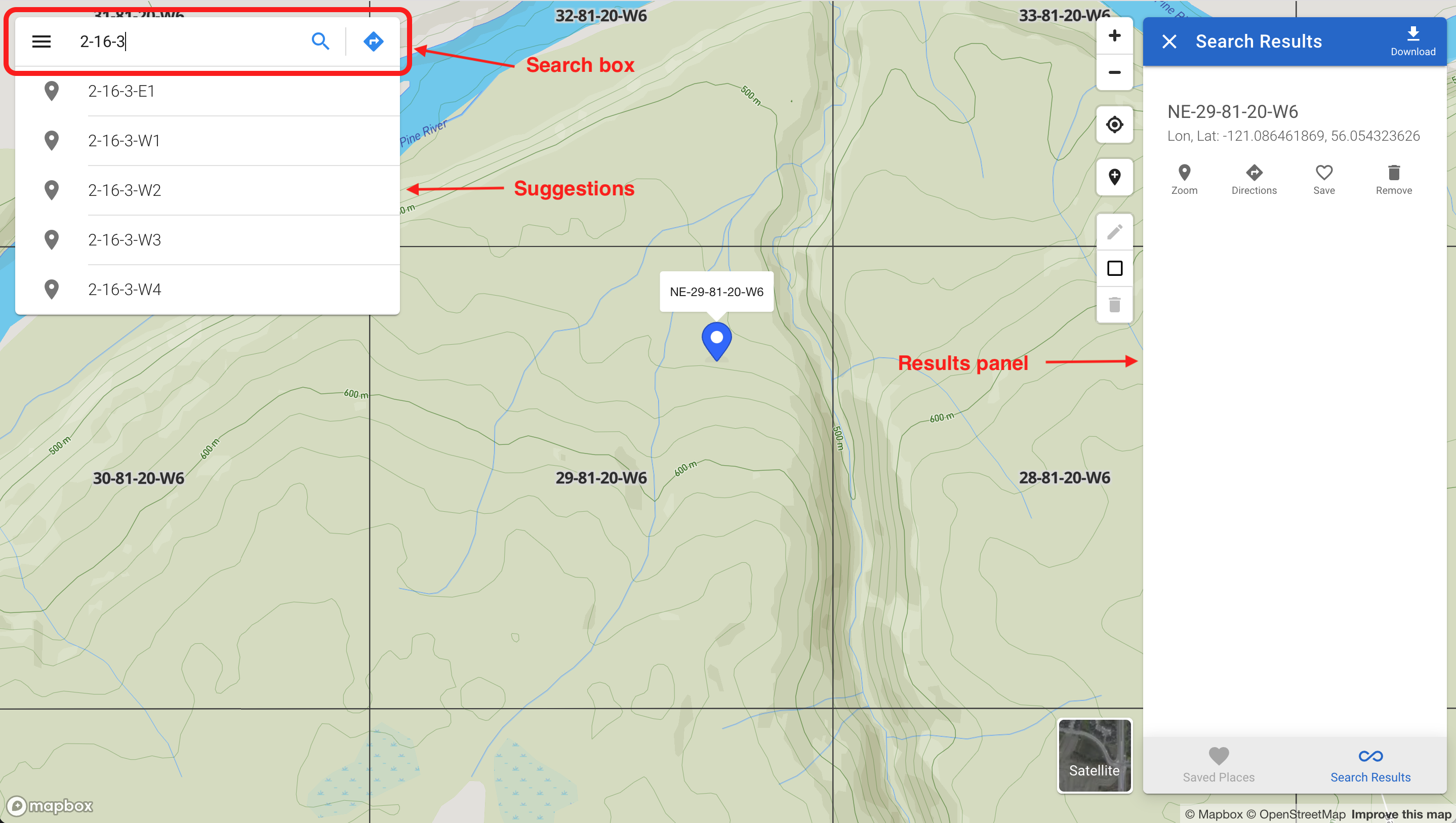
The results panel lists the search results, where each item includes the name of the location, its legal land description, geographic coordinates, and address. Below each item are four buttons:
- A "Zoom" button to focus on the location on the map
- A "Directions" button for route guidance
- A "Save" button to save the location
- A "Remove" button to delete the location from the map
Searching by legal land description
Township Canada accommodates various survey grid systems like Dominion Land Survey (DLS), National Topographic System (NTS), Geographic Townships, and Federal Permit System (FPS), each with its unique format for legal land descriptions. For instance, the DLS system uses a grid of LSDs, Quarter Sections, Sections, and Townships.
Inputting a complete legal land description isn't mandatory; a partial description will also prompt suggestions. Choose a suggestion or press enter to search with your input. Separate components of a legal land description with spaces, hyphens, or both (e.g., SW 25 24 1 W5, SW-25-24-1-W5, or SW 25 24-1W5).
Searching by geographic coordinates
Find locations using geographic coordinates such as GPS coordinates in formats like decimal degrees (e.g., 51.454928, -114.648933) and degree minute seconds (e.g., 51°27'17.7"N 114°38'56.2"W). The order of latitude and longitude is interchangeable, so both 51.454928, -114.648933 and -114.648933, 51.454928 are valid. Input the coordinates and press enter to initiate the search.
Searching by place names, addresses, or postal codes
To locate places and addresses, enter the name of a place, an address, or a postal code. The search box will offer a list of suggestions as you type. Select a suggestion or press enter to search with your current input.
Searching by clicking on the map
Alternatively, find legal land descriptions, geographic coordinates, and addresses by clicking on the map. Select the marker button from the top-right corner of the map and click on your desired location. The results will appear on the map and in the right-side panel.
Downloading search results
You can download search results in various formats, including CSV, KML, Shapefile, DXF, and GeoJSON. These formats are compatible with applications such as Excel, Google Earth, CAD, and GIS software. To download, click the "Download" button, located at the top-right corner of the results panel, and select your preferred file format; the file will then be saved to your device.