Work with an interactive map
The map feature in Township Canada is a dynamic tool designed to enhance your ability to visualize and interact with spatial data. This guide will walk you through using the map for exploration and analysis and demonstrate how you can tailor the map to fit your specific needs.
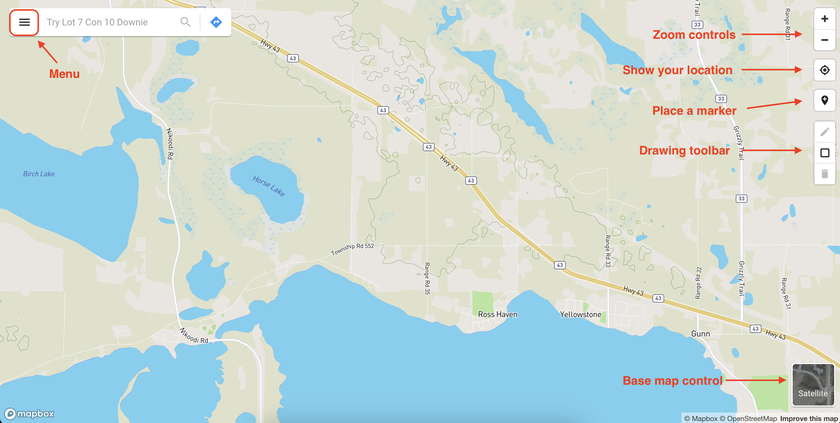
Navigation controls
The map is equipped with intuitive navigation controls located in the top-right corner. These controls include:
- Zoom: Adjust your view of the map by zooming in and out using the zoom control.
- Show Your Location: Activate the "Show your location" button to display your current location on the map.
- Place a Marker: Click on a desired point on the map to place a marker at that specific location.
Interactive features also include the use of your mouse or touchpad. You can pan across the map by clicking and dragging, and adjust the zoom by scrolling with your mouse wheel or using the pinch gesture on your touchpad.
Base map layers
The map offers various base map layers, allowing you to view the map in different styles, such as street or satellite views. Switch between these base map layers easily by clicking on the base map layer control located in the bottom-right corner of the map.
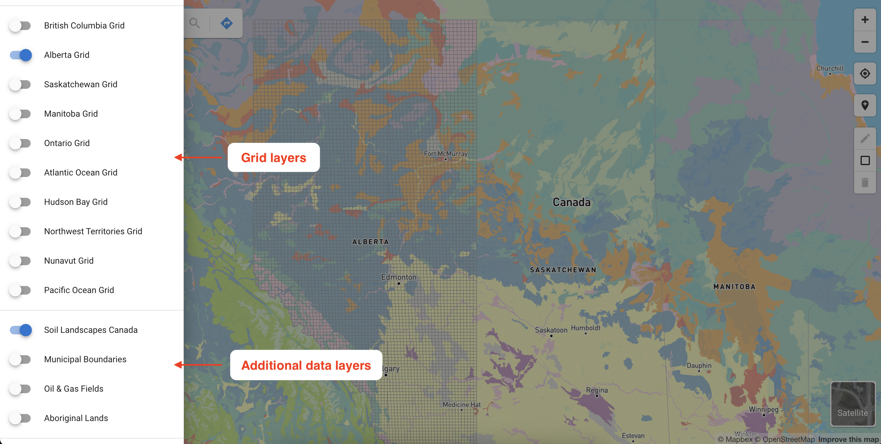
Grid layers
A range of grid layers is available to visualize data within a spatial context. These include the Dominion Land Survey (DLS), National Topographic System (NTS), Geographic Townships, and Federal Permit System (FPS), covering regions such as British Columbia, Alberta, Saskatchewan, Manitoba, Ontario, the Northwest Territories, Nunavut, and offshore areas in the east coast, west coast, and Hudson Bay.
You can toggle these grid layers on or off using the switches in the left sidebar, which can be accessed from the main menu button in the top-left corner of the map. The map remembers your layer preferences by storing them in your browser’s local storage, saving you the hassle of reactivating them each time you visit.
Additional data layers
The map also features a comprehensive data catalog for exploring and analyzing a variety of spatial data layers. These include administrative boundaries, oil and gas fields, aboriginal lands, and soil characteristics (Soil Landscapes Canada). While these layers are initially turned off, you can activate or deactivate them at your convenience in the left sidebar.
For data layers not currently available in the catalog, feel free to contact us with your request, and we will strive to incorporate them into the map.