Process thousands of legal land descriptions and coordinates
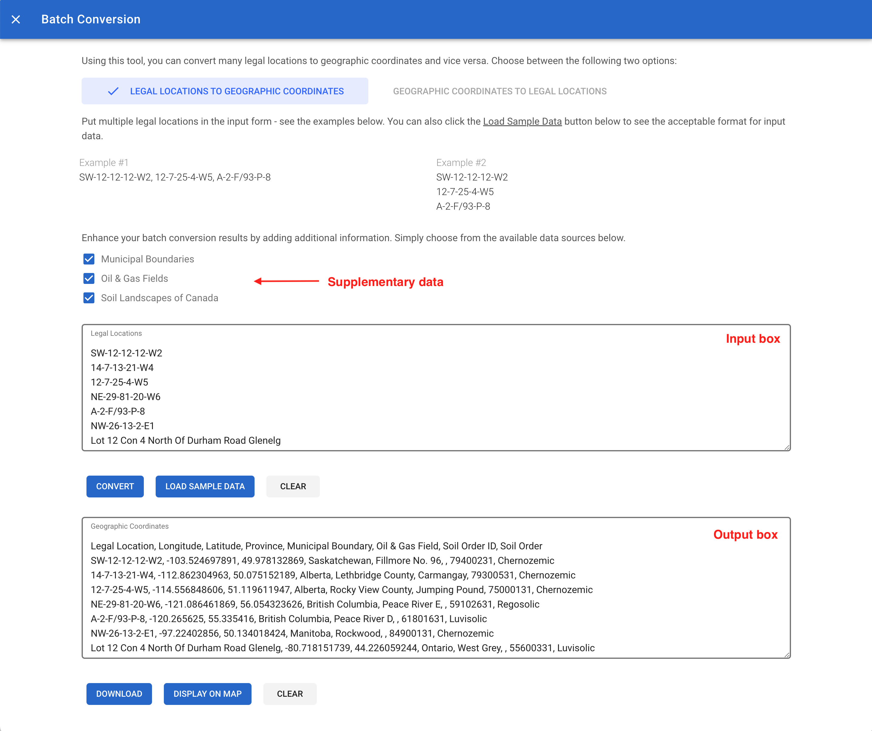
Township Canada's batch conversion tool is a versatile feature that allows you to convert multiple legal land descriptions (LLDs) into geographic coordinates and vice versa. For instance, this tool can handle over 4,000 legal land conversions in a single request. Additionally, it offers the option to enrich results with supplementary data, such as province or territory names, administrative boundaries, oil & gas field locations, and soil characteristics.
You can access the batch conversion tool from the main menu, located at the top-left corner of the map, just to the left of the search box. Simply click the menu icon and choose "Batch Conversion" from the list. The tool will then open in a new window.
Converting legal land descriptions to geographic coordinates
To convert legal land descriptions into geographic coordinates, click on the "Legal Locations to Geographic Coordinates" button. Enter the legal land descriptions in the input field, separating each with a comma or a new line. For format examples, click the "Load Sample Data" button. After entering the data, click "Convert" to start the conversion process. The resulting geographic coordinates will be displayed in the text area below, along with the original legal land description and the respective province or territory name.
Converting geographic coordinates to legal land descriptions
To convert geographic coordinates into legal land descriptions, select the "Geographic Coordinates to Legal Locations" button. Paste or type the geographic coordinates into the input field, separating each set with a new line. Click "Convert" to initiate the conversion. The results will include both the geographic coordinates and their corresponding legal land descriptions.
Enriching batch conversion results
Enriching your batch conversion results with additional data is an optional step. By selecting the appropriate checkboxes, you can include information about administrative boundaries, oil & gas fields, and soil characteristics, alongside the province or territory name, which is included by default. The enriched results will display a comprehensive set of data for each conversion.
Displaying batch conversion results on the map
The batch conversion tool also allows for the display of results directly on the map. To visualize your data, click the "Display on Map" button. Markers representing each conversion will appear on the map, showing the legal land description, corresponding geographic coordinates, province or territory name, and any additional enriched data.
Downloading batch conversion results
For further analysis or record-keeping, the tool enables you to download the conversion results in various formats, including CSV, KML, Shapefile, DXF, and GeoJSON. These formats are compatible with applications such as Excel, Google Earth, CAD, and GIS software. To download, click the "Download" button and select your preferred file format; the file will then be saved to your device.