Introducing Township America; expanding our horizons to the United States
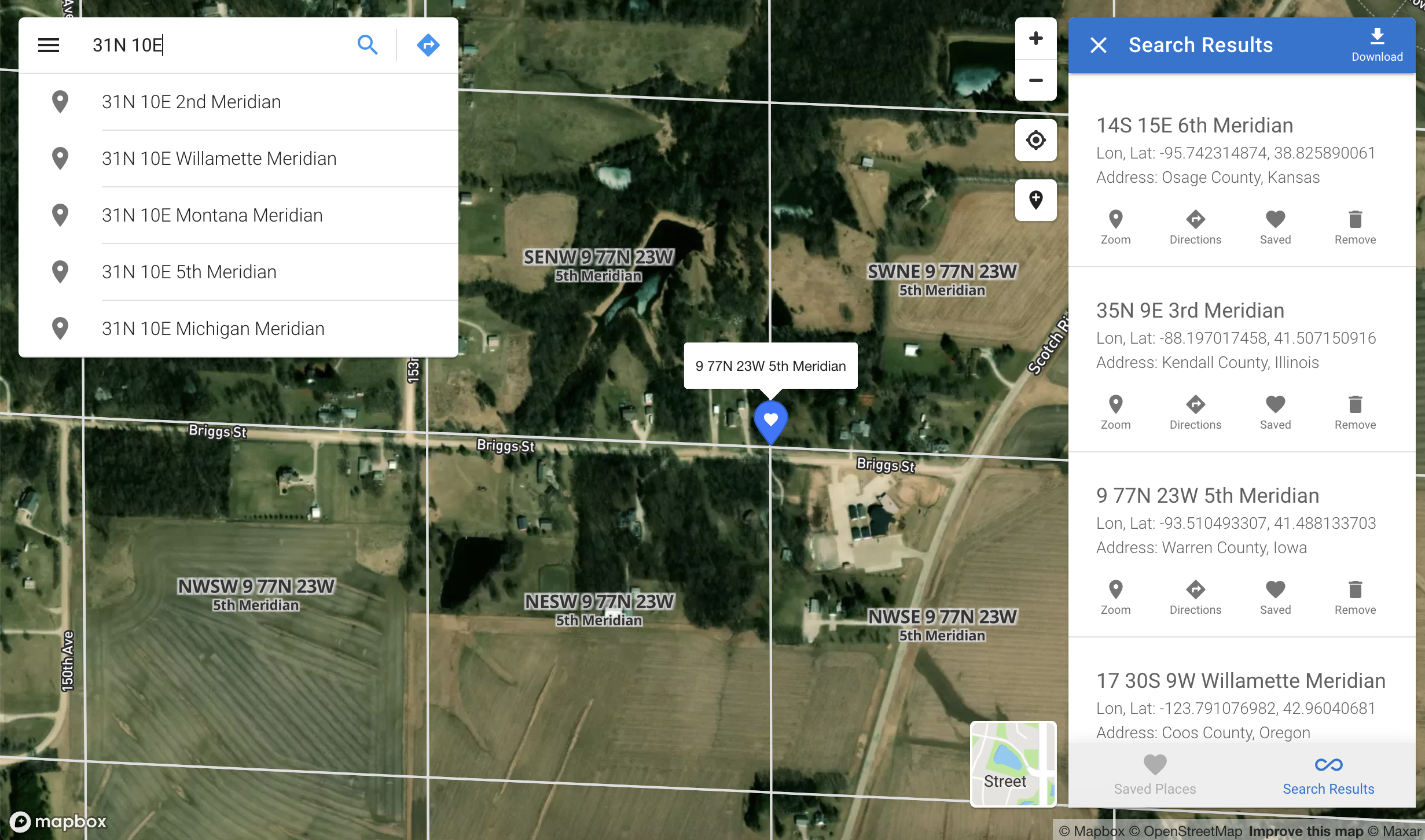
The Public Land Survey System (PLSS) is a cornerstone of land surveying in the United States, established in the early 19th century to facilitate orderly land surveying and management. Utilizing a grid system, the PLSS divides land into townships and sections, a framework integral to legal land management, real estate, and resource management.
Today, we are excited to announce the launch of Township America. This new platform brings the robust tools and services of Township Canada to the US, providing advanced mapping and legal land description services. Whether your focus is on agriculture, real estate, insurance, natural resources, or land development, Township America is designed to support your work with precision and ease.
Expaning coverage across 30 states
Township America's coverage spans 30 states, including Alabama, Alaska, Arizona, Arkansas, California, Colorado, Florida, Idaho, Illinois, Indiana, Iowa, Kansas, Louisiana, Michigan, Minnesota, Mississippi, Missouri, Montana, Nebraska, Nevada, New Mexico, North Dakota, Ohio, Oklahoma, Oregon, South Dakota, Utah, Washington, Wisconsin, and Wyoming. Our platform facilitates various legal land description searches, such as:
- Township Range Meridian (e.g., 6S 19W 5th Meridian)
- Township Range County State (e.g., 6S 19W Clark County Arkansas)
- Section Township Range Meridian (e.g., 4 2N 18E Indian Meridian)
- Section Township Range State County (e.g., 4 2N 18E Pushmataha County Oklahoma)
- Quarter-Quarter-Section Section Township Range Meridian (e.g., NESW 25 5N 30E Mount Diablo Meridian)
- Quarter-Quarter-Section Section Township Range State County (e.g., NESW 25 5N 30E Mineral County Nevada)
Key features
- Advanced search: Easily search legal land descriptions, geographic coordinates, and places, with results displayed on an interactive map.
- Interactive mapping: Explore US legal locations (PLSS), geographic coordinates, and more on a user-friendly, interactive map.
- Data storage and export: Save your research and export data in multiple formats like CSV, KML, Shapefile, DXF, and GeoJSON for integration with various applications, including Excel, Google Earth, CAD, and GIS tools.
- Batch conversion tool: Convert many legal locations to geographic coordinates and vice versa.
- API integration: Integrate our services into your applications and workflows using our robust API.
Get started today
We invite you to explore Township America and discover how it can enhance your work with legal land descriptions in the US. Whether you're in the agricultural sector locating farms, in oil and gas managing assets, or in the insurance industry assessing lands and properties, Township America is designed to support your specific needs.
Your input has been vital in shaping Township Canada, and we eagerly anticipate your feedback on Township America. For any inquiries or suggestions, please reach out to us. We're excited to extend our journey to the United States and grow alongside you.